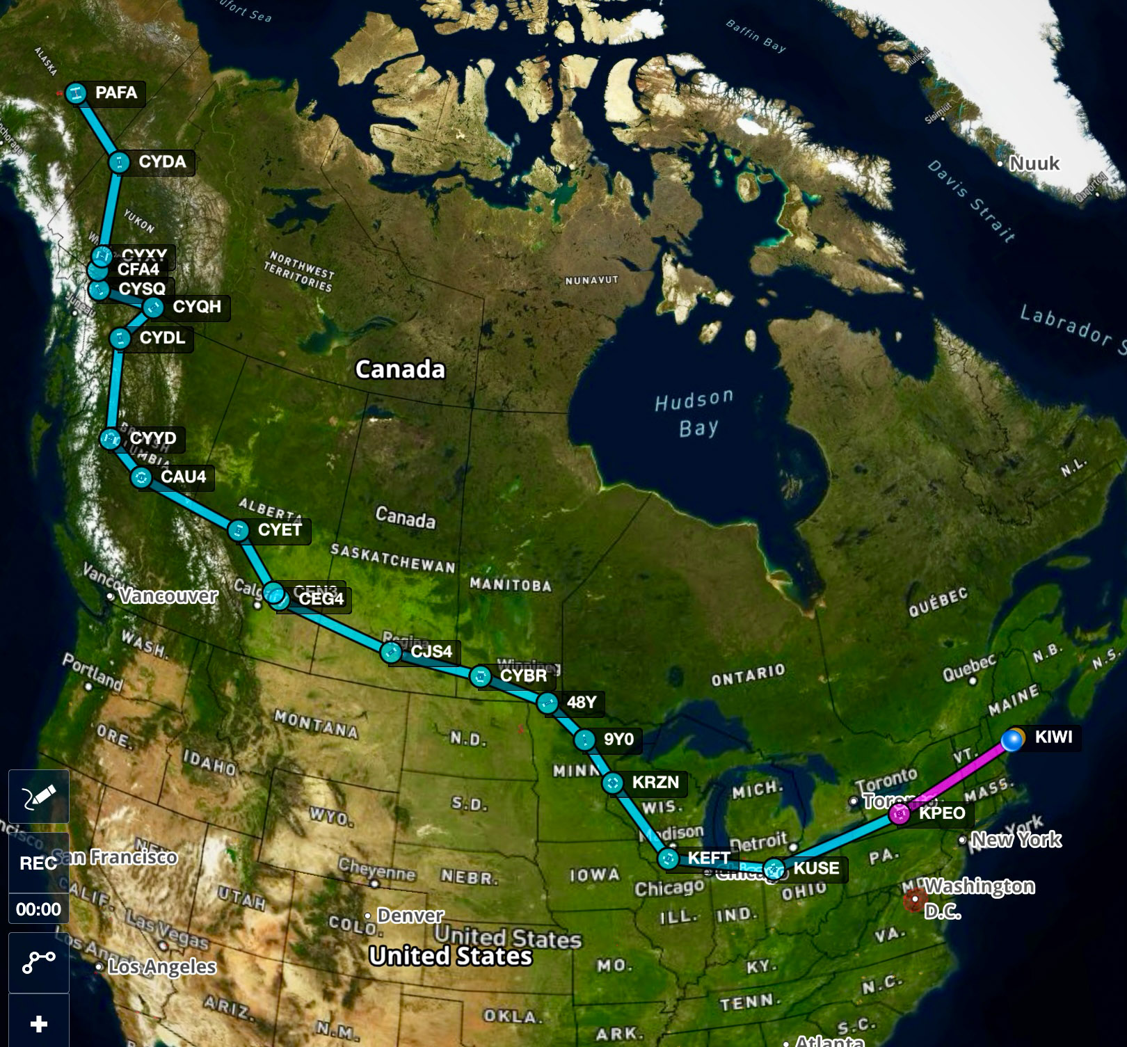
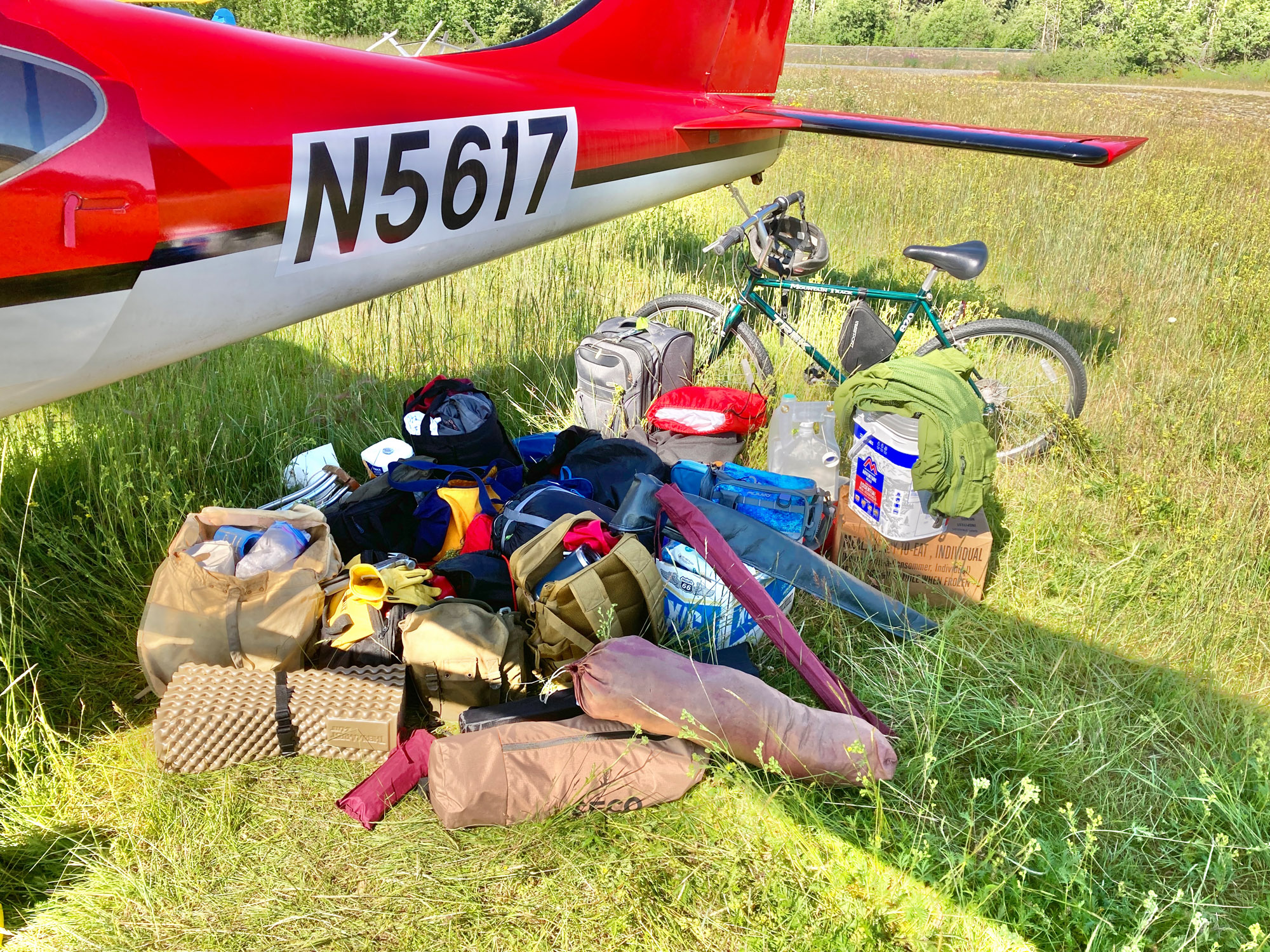
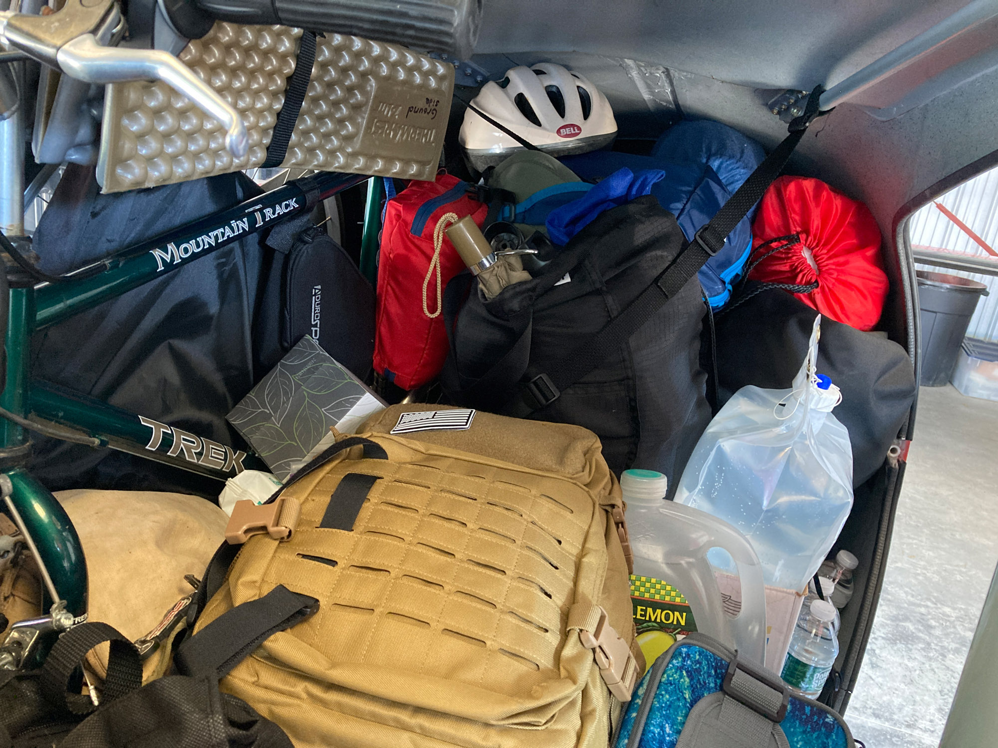
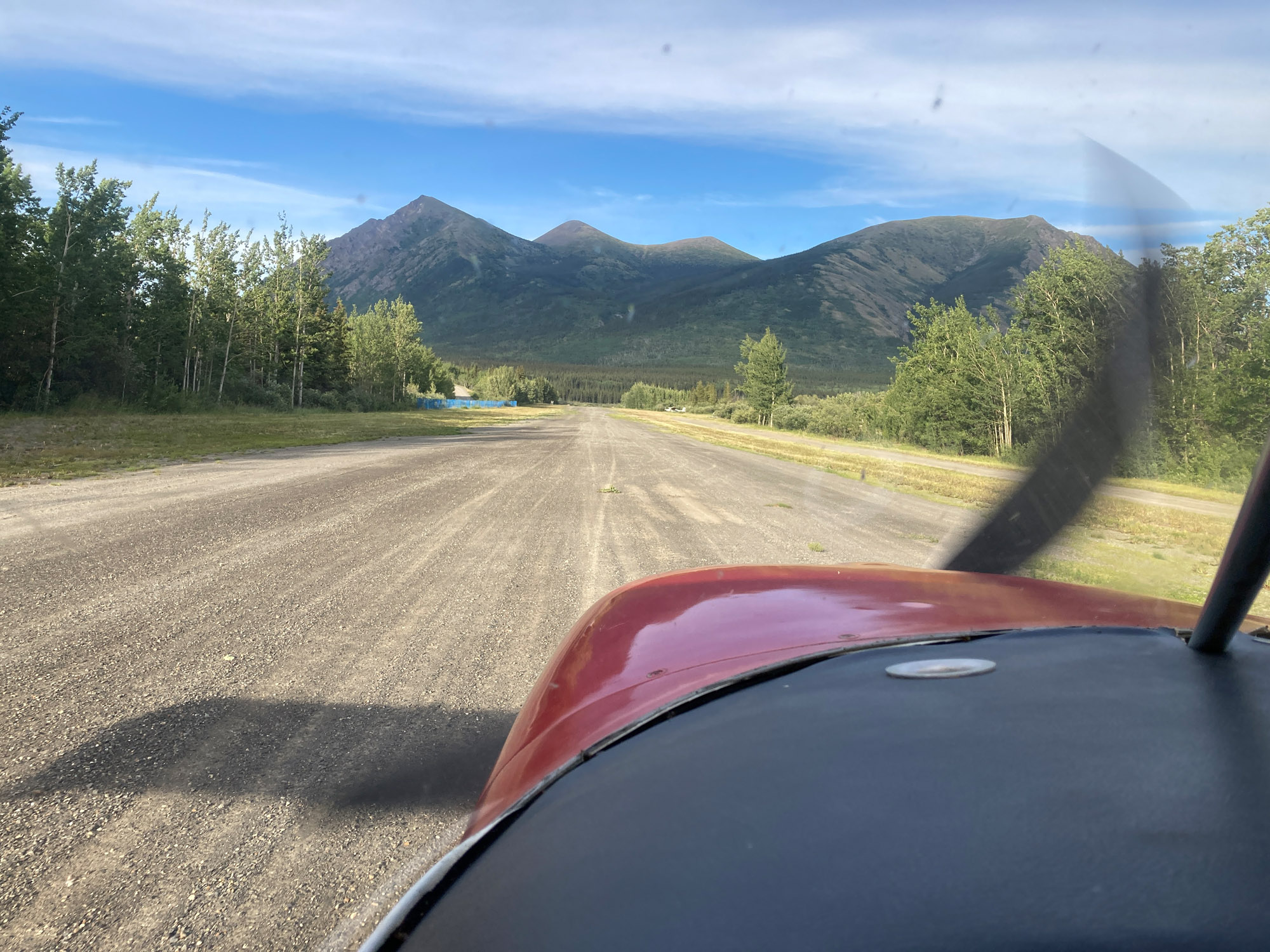
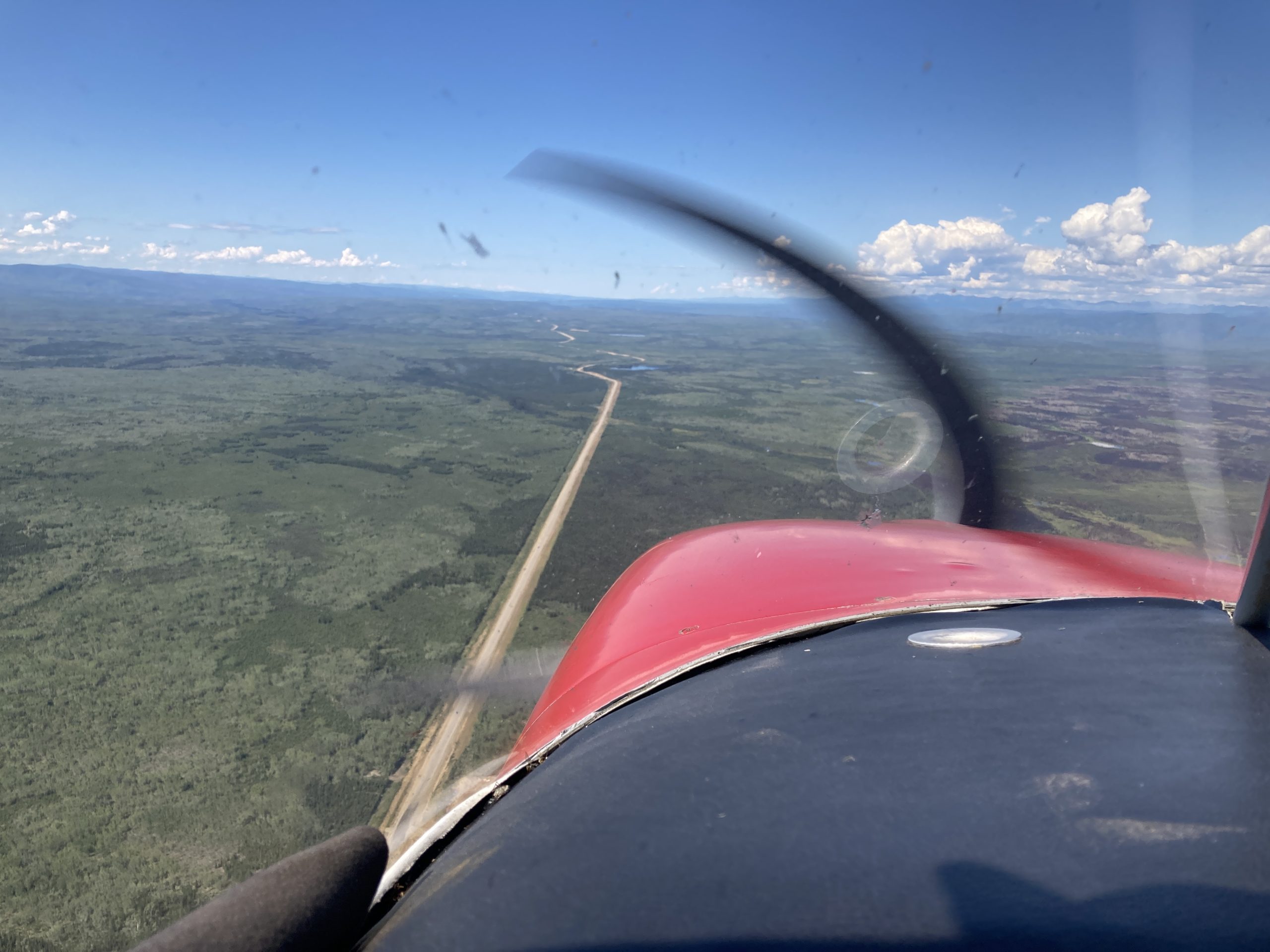
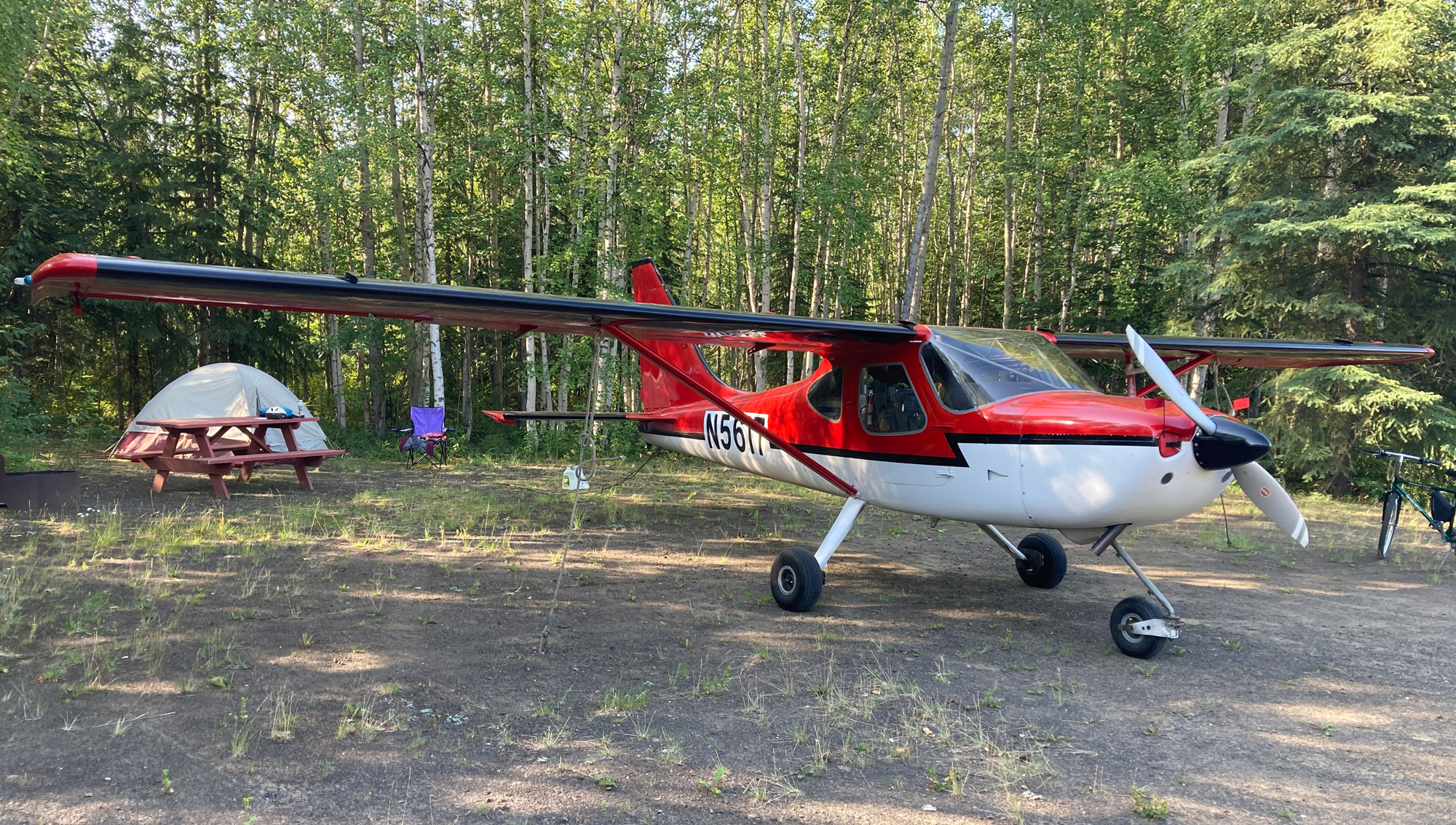
I flew my Glasair Sportsman solo from Maine to Alaska and back. The Sportsman is tricycle gear with steam gauges. I’m a VFR pilot and I’ve never flown a plane to Alaska before. I departed Maine on July 9, 2024 from Wiscasset Airport (KIWI). I flew across Canada, all over the Yukon and the Klondike Gold Rush area. In Alaska, I went as far north as Fairbanks, explored Denali, flew over glaciers and to the coast south of Homer. I traveled for a month, logged 98 hours of flight time and flew 7500 nm (8600 sm); a distance equal to a third of the way around the globe. I camped and stayed at motels. I had 250 lbs of baggage including camping gear, MREs, survival equipment, quarts of oil, lots of water, everything needed to jack the plane and replace a tube, and a full-size bicycle. I was prepared, ready to explore, and go on an odyssey.
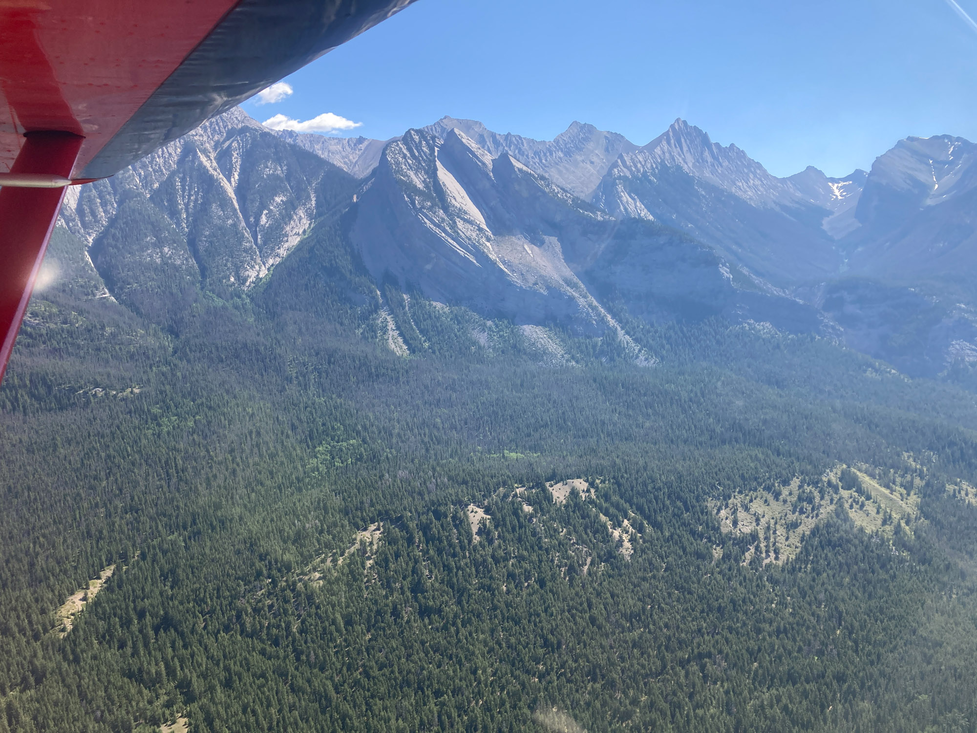
It was the adventure of a lifetime. The mountains and passes are unlike anything in the lower 48—the land is unbelievably rugged and remote. The scenery is breathtaking. Here is the story along with the route, lessons learned, tips, equipment, and supplies.
Preparation
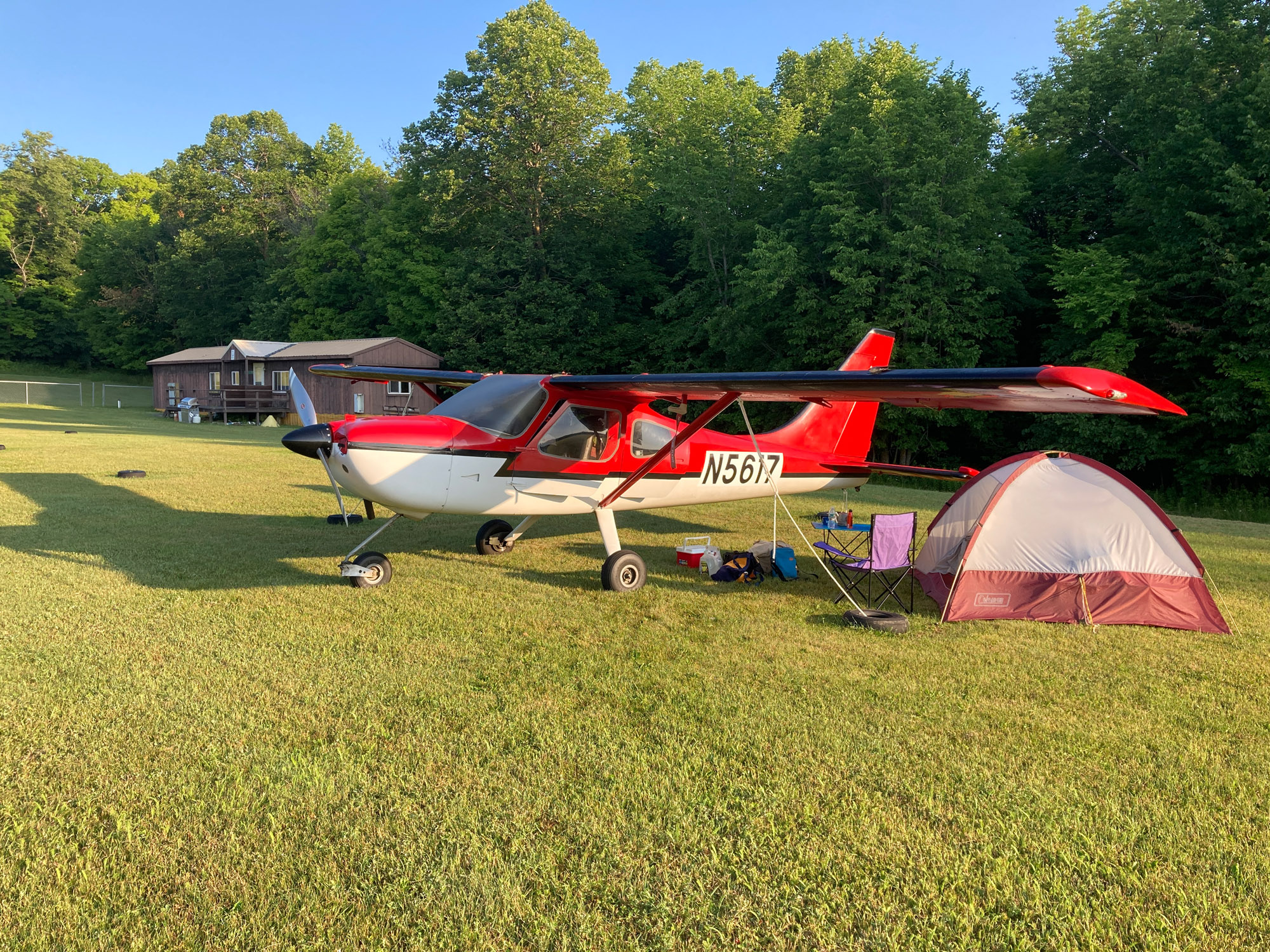
I flew alone and needed to be self-reliant. I was concerned about surviving a forced landing or being stranded at a remote location for days due to weather or a breakdown. I had no firm itinerary and didn’t want to be constrained by reservations. I expected to be at airstrips without motels and restaurants. I stayed in hotels 13 nights of which half were en route. You may not need all the items I took, but you may need some.
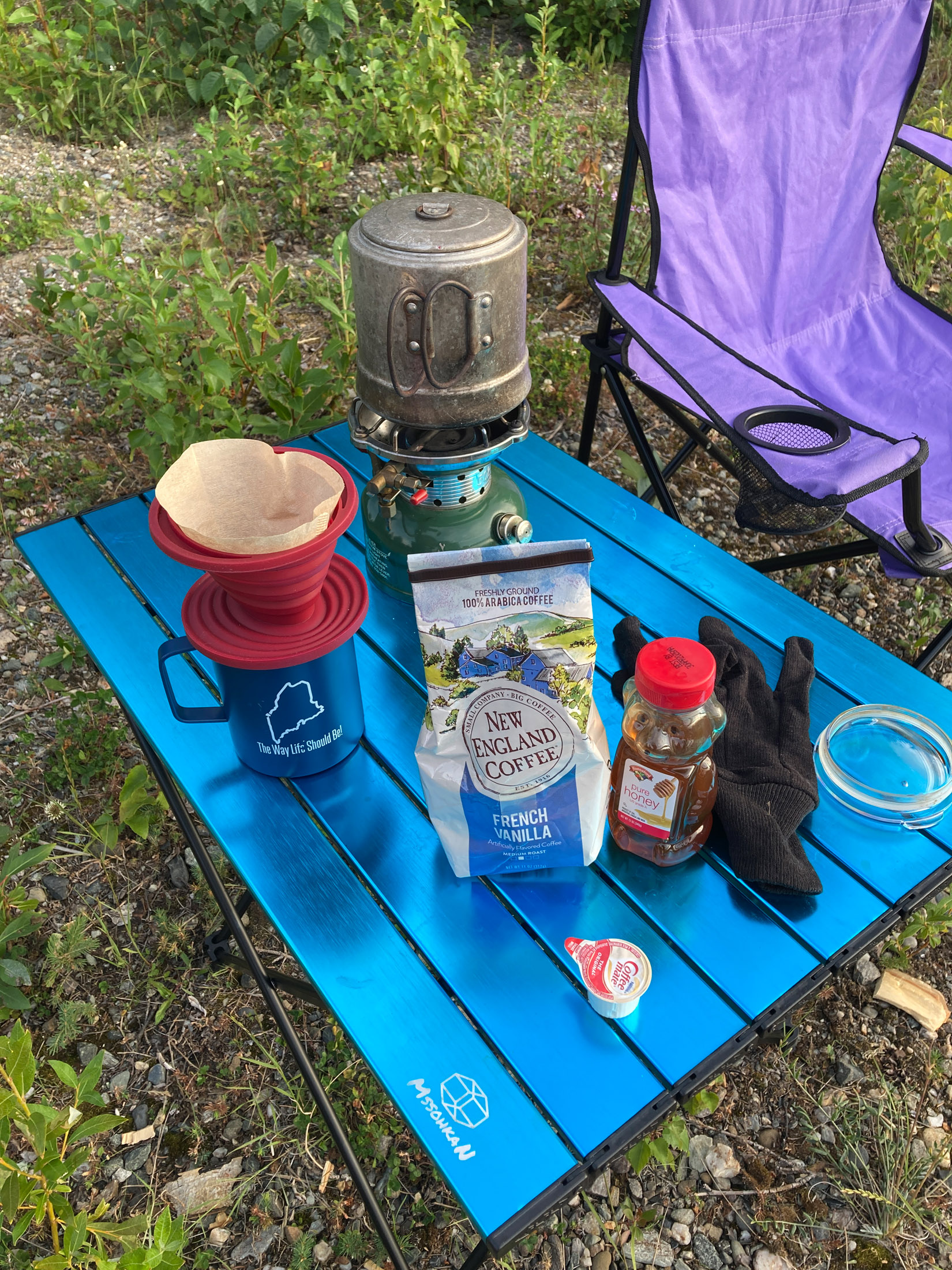
Even when sharing equipment with another aircraft or staying in towns and doing day trips, a tent and sleeping bag are recommended in case lodging is sold out and for emergency use. A small stove for hot coffee and something to eat in the morning allows for an early start and positive outlook. Bring clothes for both moderately cold and hot weather in July (32-80°F)
Aircraft Tools and Supplies
See All Items Taken List. Items deserving special mention are:
Tube Change Kit
I wanted the ability to remove a tire and replace a tube. I didn’t rely on Slime leak stop because flat tires are often caused by damage at the valve stem, which Slime can’t fix, and there are other leaks Slime can’t fix. The kit included: a main and a nose tube, valve cores, a lightweight 1 ton scissor jack and a high quality miniature rechargeable electric air pump. The jack can be operated with a socket and socket wrench should the ratchet handle fail.
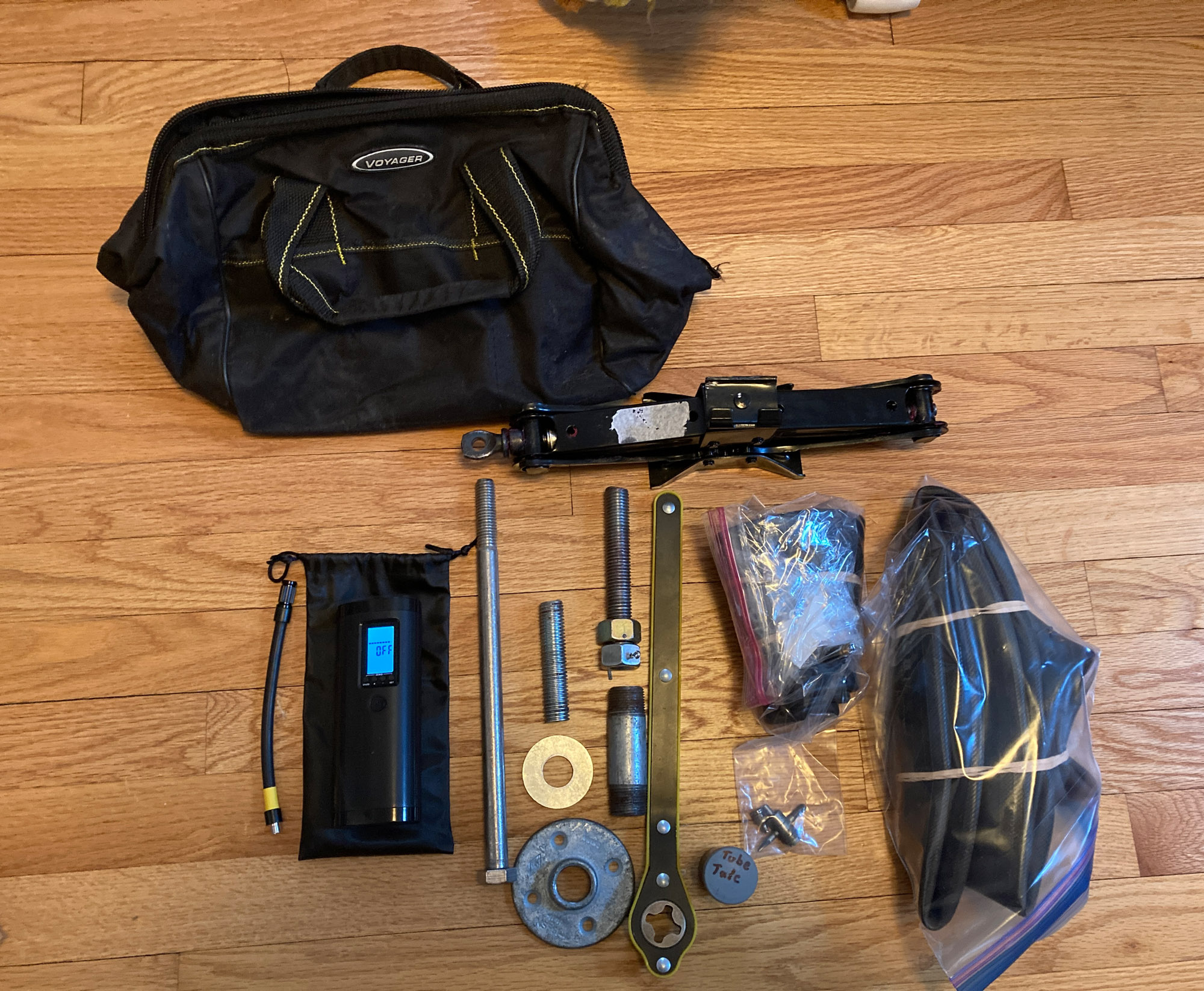
Test before you go
This Sportsman has jack pads. Testing the screw jack showed it would not fit if the tire was flat. I still took it to use as a stand. The wrench to remove spark plugs wouldn’t fit between the cooling baffles and was replaced. The VEEAPE 150 psi electric air pump, predominately used for bicycles and motorcycles, had no problem filling the high pressure nose wheel. It barely reduced the charge filling a main tire from low to full. Beware – there are many poor quality knockoff pumps.
Shovel & Bow Saw
A shovel can be invaluable in getting out of soft gravel or a wet spot where tires have sunk in. I was “one more try” before resorting to it a couple of times. Use a genuine US Army entrenching folding shovel. The reproductions are prone to failure. Remember to lubricate the threads. A bow-saw can be used to cut branches to fill in a wet spot. The AGAWA Boreal21 bow saw folds. I did not bring a come-along due to bulkiness.
Metric and Special Tools
Check the need for metric and special tools. For example, battery cable bolts on the Odyssey battery require a 10mm socket. The brake fluid reservoir requires an allen wrench. It is helpful to know which SAE sizes can be used for metric.
Jump Pack Connection
I wanted the ability to operate and disconnect the jump pack from within the cabin because some jump packs require a button to be pressed if a battery is dead, have a quick timeout, or require immediate turn off after engine start to avoid damage. Also, I didn’t like the idea of a pack and wires outside the aircraft being moved by prop wash. I installed a receptacle under the oil filler door. A cable could be temporarily run from the receptacle, through the NASA vent, through the cooling vent into the cabin to the jump pack. This enabled disconnecting power and controlling the YaberAuto 6000A jump pack in the cabin.
A Way to Transport and Filter Fuel
A Wolverine 2.5 gallon double wall plastic container that folded to about 4″x5″x2″ served as an emergency method to transport fuel. I tested the container with aviation gas to ensure it wouldn’t leak. A genuine chamois cloth was carried to filter. This is a common old school method. Use real chamois, not the synthetic. Another option is a filtered funnel. The filtered funnels I saw were too bulky. A cut plastic water bottle for a funnel and a hard cooler to transport fuel can be used in a pinch. During a flight where backtracking due to weather would have required landing at an airstrip without fuel service, having a way to carry fuel to an airstrip reduced the concern.
Alternator Belt
Replacing an alternator belt requires significant work especially on an aircraft with a constant speed prop. I carried a Power Twist Adjustable Link V belt Type A 1/2 ” x 48″ by Ketofa. I was skeptical until reading these are used in machine shops with favorable results on tools taking five times more power than a 60w alternator.
Windshield Cleaning
There were flights where bugs almost obscured the windshield. Flying in Maine where there are lots of bugs, I thought I knew how to clean bugs off a windshield. Wrong. Bug removal with water and a clean cloth is not sufficient. As taught by a Canadian helicopter pilot, I carried a water bottle with a less than 5% solution of airplane wash and water. Wet the windshield with water, then wet with the wash, then wipe with bare hand. The bugs come right off. Rinse with water. Wipe vertically with a blue shop towel. This method works wonders! I didn’t find applying Plexus necessary although it may help.
Camping Equipment and Supplies
Items deserving special mention:
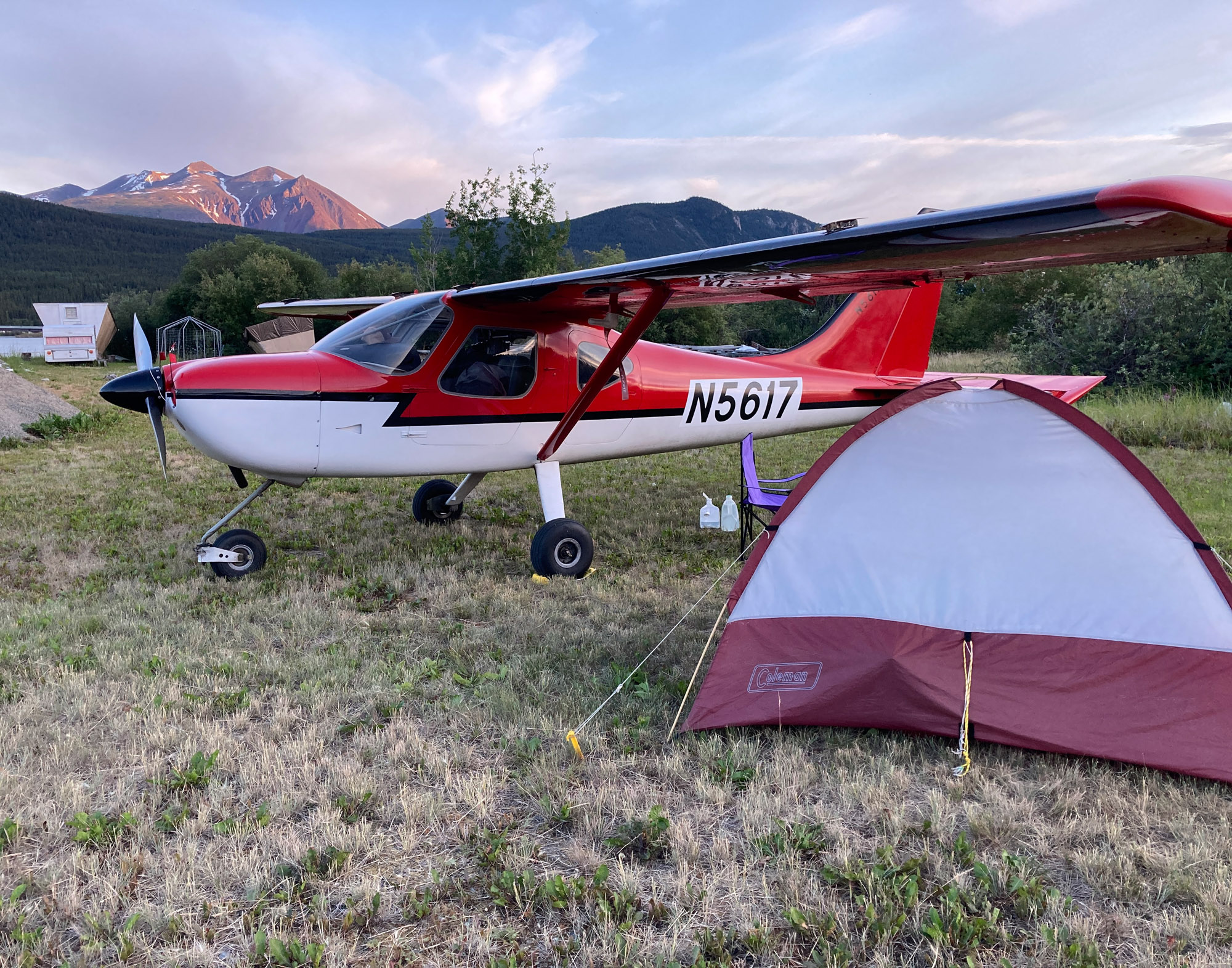
Lightweight Folding Cot
This cot improved the comfort factor immeasurably. It resulted in a good night’s sleep, provided a sitting position which made putting on socks and pants easier, and kept my body off the cold tent floor. Being 15″ off the ground, there was storage underneath. I placed a Therm-a-Rest Z Lite Original pad on the cot for insulation and comfort. Compared to the cot, the air mattress used in the past took much more time to deflate and pack, was heavier, bulkier, and required a pump and possibly a spare. Battery pumps are heavy, hand pumps are bulky. The ICECO camping cot weighed 6 lbs. and measures about 22″x6″ packed. Avoid the cheap ones.
Portable Folding Toilet
Knowing you always have a place to go provides piece of mind. This portable toilet with lid weighs little, collapses compactly, isn’t tippy, and supports lot of weight. It also can serve as a seat. The AWWVVA Upgrade XL Grey Portable Toilet with Lid measures 11″x14″x3″ folded and weighs 4 lbs. Use with included scent packs, or kitty litter, and trash bags.
Folding Table
A 27″x18″ accordion style folding table by MSSOHKAN was used for meals and to keep items off the ground when setting up camp. A smaller table wouldn’t have been as useful. It weighed only 3 lbs and folded to 26″x 6″x 2″.
Stove
The stove was an old one burner Coleman that runs on camp fuel/white gas. Avoid alcohol stoves in Canada. Stove alcohol is not sold anywhere as one flyer I met learned the hard way. Extra fuel was carried in a 1 qt. container designed for the purpose. I brought a repair kit. A wind break would have been helpful.
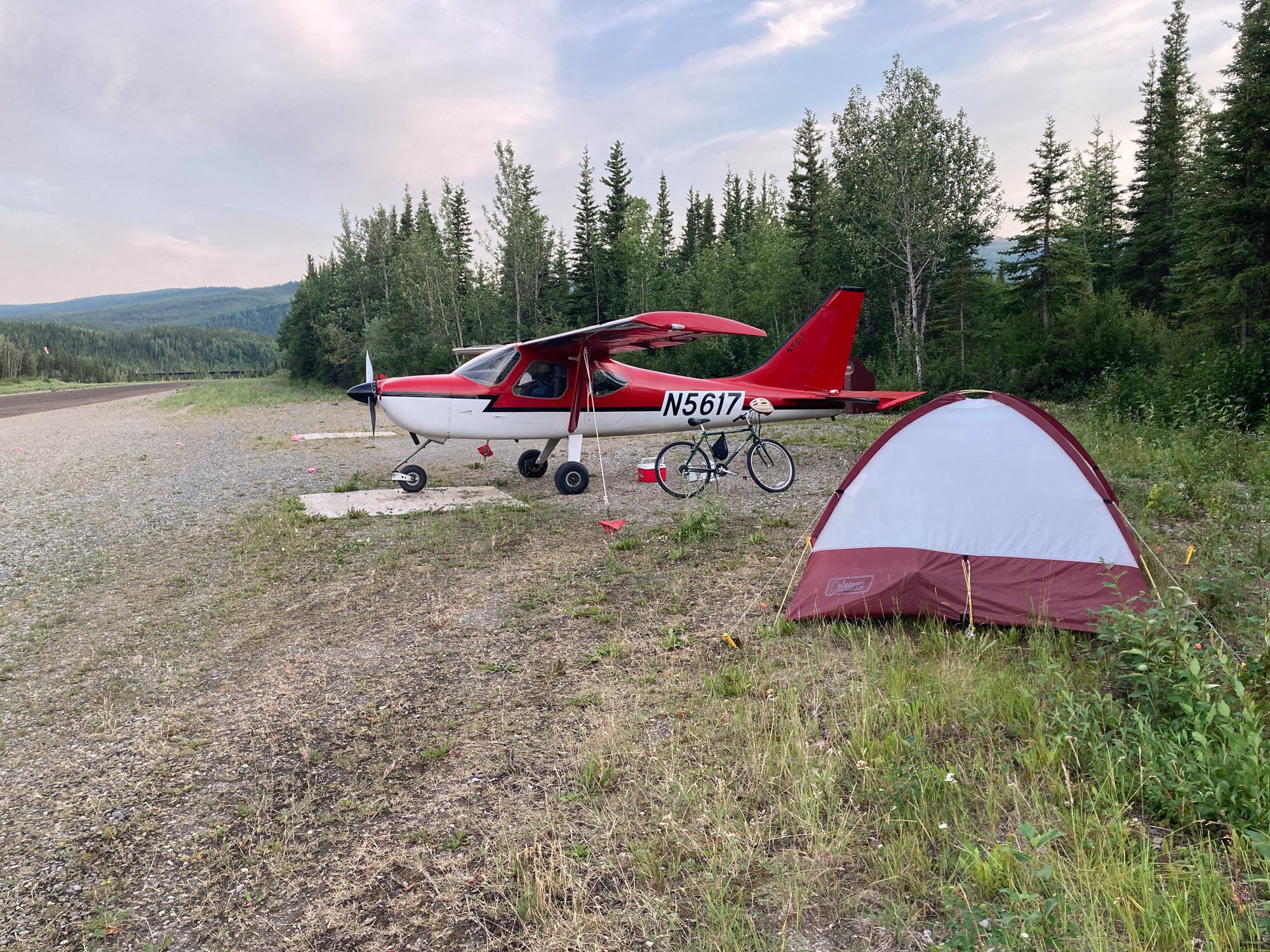
Bicycle
I thought bringing a bicycle was probably silly. It turned out to be one of the most useful items. Uses included going to town, restrooms, Wi-Fi, electric outlets, a restaurant at the opposite end of a one mile runway, and the Denali bus center. The bicycle was a Trek hybrid 26″ wheel. Bicycles with small tires don’t do well around gravel airstrips and dirt paths. Only the front wheel, seat and pedals were removed to get the bicycle in the plane. A wooden piece was made for the forks to set on. There are locking fork devices; unnecessary in my case, as the bicycle was packed in tight. I brought a spare tube and electric air pump. The bicycle weighed 20 lbs.
Food and Water
The objective was to bring food for camping plus enough to survive 1-2 weeks. I brought MREs (Meal, Ready to Eat – US Army) and Mountain House freeze dried food. Both were surprisingly good. I’d give the edge to the MREs. The MRE tasted better and always contained side items like apple sauce, jerky, or cookies for variety. The MRE water activated chemical heater made it unnecessary to use the stove. In addition, I had a few canned items (heavy), cereal bars, coffee and the like.
For drinking water, I had 15 bottles of Maine Poland Spring water. The thinking is that in event of a crash, not all bottles are likely to break. Most of the water was kept in a small cooler which could be used for other purposes if needed (transport liquids, table in the tent). Two 1 gallon containers (one collapsible) held tap water for making coffee and freeze dried food.
First Aid
Off-the-shelf first aid kits are only start. They are good for small injuries but lack items for trauma and medications.
First aid supplies were categorized as follows:
- For minor injuries: Cuts, small burns, injuries around the campsite
- For trauma: Broken limb, severe bleeding, serious burns; airplane crash, major fall
- Medications: For sickness, pain relief, insect bites, antiseptics
- Other items
I did research and consulted a former 82nd Airborne paratrooper on trauma items to add. She recommended: Israeli bandage, SAM splint, Bleed Stop, a tourniquet, burn ointment, means to cleanse a wound, and electrolytes.
The kit was supplemented with antiseptics for cuts, insect bite treatment, and medications for pain relief, fever, diarrhea, upset stomach and muscle soreness.
Other items included: A dental kit for temporary filling repair. A toothache makes eating difficult and clouds thinking. A blister kit. (You may have to walk a long way). A digital thermometer to monitor fever. First aid booklet.
Have a list of contents in the first aid kit. Knowing what is in the kit will help you and anyone providing assistance.
Survival Vest
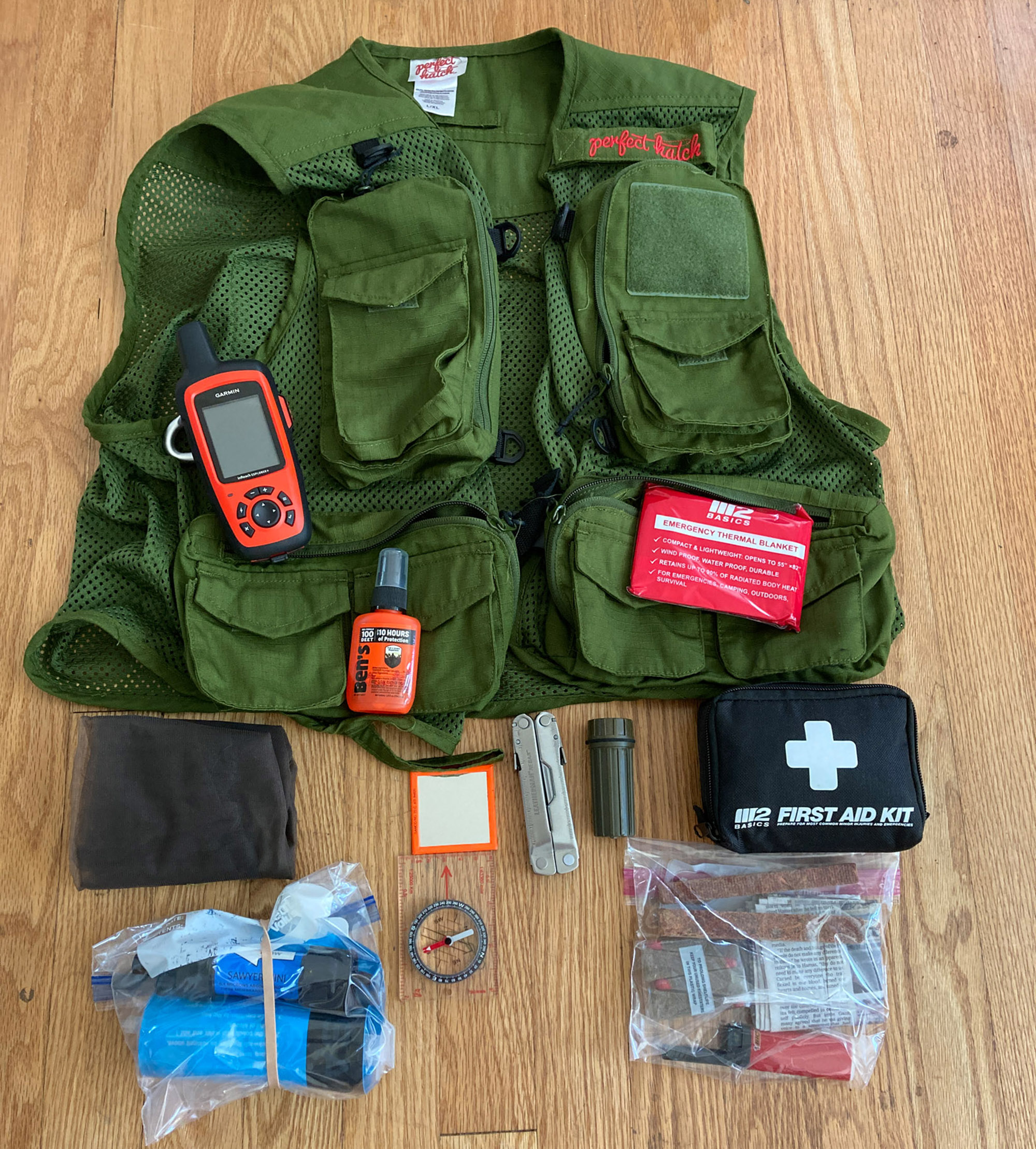
Items deserving special mention:
In a forced landing, the only equipment you have may be that which you have on you. I carried survival items in a fishing vest which was worn when flying over particularly remote territory. When not worn, it was within close reach. The vest carried a Garmin InReach PLB satellite locator messenger. According to Alaska pilots, other brands don’t work reliably that far north.
Other items included fire making, water purifier and container, compass and mosquito net (mosquitoes can drive a person mad). A twist on flashlight was used; a push button may turn on when jostled.
I also had a Grab and Go Bag. This small bag included bear spray, means to make a fire, compass, paracord, light sticks and a Wallace survival booklet. “Two is one. One is none.” is a survival mantra. I had multiple ways to make fire, two compasses and two ways to purify water (filter and tablets). It is important to have a way to carry water.
Electronics and Charging
Battery Powered Devices
Rechargeable devices included an iPad, iPhone, Stratus ADS-B, Garmin PLB, lantern, headlamp, flashlights and Kindle. A plan was needed to keep electronics charged. The objective was to be able operate 4-5 days off the grid if needed.
Of primary concern was the iPad. It maintains a charge in flight using ForeFlight. However, it was used on the ground for flight planning, weather, accommodations search, news, email etc. often for two or more days without access to electricity. Cellular data is a big drain on the battery. Even at airstrips with buildings, a place to plug in was seldom available especially after hours and overnight. Nor did I want to leave the iPad or cell phone somewhere out of sight.
Tip: Sometimes you can find an unlocked working outdoor outlet used to plug in an aircraft engine heater.
My rule was not to depart with the iPad at less than 50% as that leaves only 3 hours of flight time if recharging in the air was not working. (A power pack was within reach if needed.)
The Stratus ADS-B was not plugged in for recharging in flight because the 12v USB charger could not charge both iPad and Stratus adequately at the same time. The Stratus runs 7 hours on a full charge thus I usually charged it after a day or two of flying. ADS-B was not used in Canada except when near the border.
Power Packs
I relied on a 26,800 mAh Anker power pack to keep devices charged. A power pack could charge an iPad about three times. I used it often. I was more comfortable leaving a power pack recharging out of sight than a phone or iPad.
I also had a second 26800 mAh Anker power pack for additional capacity. It was needed a few times. It also served as a backup in case the other pack failed. It was kept within reach when flying. With two packs, I had capacity to keep devices charged for 4-5 days if necessary.
Bringing 6′ 120v extension cord proved very useful. Three devices could plug in at once. Difficult to reach receptacles were used in restaurants and other places.
The 6000A YaberAuto Jump Starter could charge electronics if needed.
A spare 12v USB charger, cables, USB AC chargers and two pocket size power packs were taken.
Backup iPad
Having once dropped an iPad face down on a concrete floor, I had a backup iPad with ForeFlight and Canadian charts. It could be used for navigation and WiFi but not cell data. The backup iPad also provided an alternative in event of a software problem. No problems were experienced with the iPad. I also had paper charts for Canada. They were helpful in getting the big picture for planning the trip but were generally not used during the trip.
Firearm and Customs Procedures
One doesn’t need a firearm to fly to Alaska and camp at inhabited airports. Bear spray is my first choice for bear deterrence. Hitting a charging bear with a bullet requires skill and practice.
I brought a firearm in the event of a forced landing as survival tool for hunting, signaling, and deterrence of aggressive animals. A firearm used to be required when flying in Alaska. I figured they had good reasons. It can also provide protection from two legged animals in remote places.
I brought a Mossberg 500 pump action shotgun with 18.5″ barrel and nylon stock. It is light and compact. A sling was added to keep hands free when walking. For ammo I had various sizes of bird shot, buckshot for game and Brenneke Green Lightning Heavy Magnum slugs. This is the same slug used by Alaska wildlife employees for bears as they are only allowed to carry shotguns. I contacted the manufacturer. This is a special design which uses a plunger for extra penetration. The Brenneke Black Magic Magnum is a slightly more powerful version.
Firearm Transport and Customs
Traveling with a firearm through Canada to Alaska was easy. Bring a permitted type of long gun (no hand guns). Fill out RCMP form 5589 in triplicate in advance but do not sign. Make the initial landing at an airport with customs facilities. Declare and pay $25 CD. The non-resident permit is good for 60 days and useable for any number of crossings.
I suggest not using your CANPASS number when calling for the initial crossing because they start processing over the phone and they can’t take credit card payment until you are in Canada and they can’t give you a report number to enter until the payment is made – Catch 22 as I experienced. After you are in the system and reenter Canada, you may or may not be met by customs at an AOE15 airport due to the firearm. I was told I would be but was not.
Preparations to return with the firearm to the USA must be made before departing the USA. Fill out US Customs form 4457 Certificate of Registration for Personal Effects Taken Abroad. Put the make, model and serial number on the form. Bring the firearm and form to a Customs and Border Protection Office for examination and signature before leaving the USA. Have form 4457 with you when crossing back into the USA. The form is good for subsequent crossings.
Bear Spray
Counter Assault appears to be the most common and respected brand used in the north. I brought Counter Assault 8.1 oz. 32-Foot which has more range and spray time than most competitors. Check the expiration date. It can be carried in an optional holster.
Transporting bear spray in an aircraft requires precautions. I used a transport container from Counter Assault. It has absorption material and a small hole to relieve pressure. The container was then inserted in a zippered bag. Some wilderness pilots will not carry bear spray in an aircraft. They carry it in a container attached to a strut or in an external pod.
Routes to Alaska
There are four routes to Alaska:
- The Alaska Highway to Watson Lake. This is the easiest route. It flat land, low altitude, east of the mountains, and follows the Alaska Highway via Fort St. John and Fort Nelson.
- The Trench. The Trench route goes from Fort St. John to Mackenzie, then north through a trench in the mountains to Watson Lake.
- Cassiar Highway. The Cassiar goes through mountains and river valleys from Prince George via Dease Lake to Watson Lake
- The Coast. The coastal route goes along the coast via Ketchikan, Juneau, Valdez
I planned for all routes except the coast. You may not know which route you will take until you get there. Weather, smoke, and wildfire TFRs may change plans.
The Cassiar Highway route was my first choice. The Alaska Highway had wildfire TFRs around Fort Nelson. The Trench northbound is not the best choice for a first timer to Alaska due distance between fuel stops and a pass at the northern part, near Ware, that can close due to weather resulting in a 374 nm round trip back to Mackenzie for fuel. VFR up the coast with potential for fog, low ceilings and few places to land wasn’t a consideration. Coming from the east, the coastal route also required crossing the Rocky Mountains.
The Flight and Stops
Westward Bound
On the first day, I flew from Maine to Fulton County airport KUSE in Wauseon, Ohio. The route went under Cleveland Class B airspace over Lake Erie in MVFR to Sandusky, OH – not fun but good practice. I was stuck at Fulton County for a day due to weather. The manager was friendly and helpful including a hangar for the storm and a courtesy car.
The next flying day was to Bowstring Field 9Y0 Bowstring, Wisconsin. I highly recommend Bowstring for airplane camping. It is a beautiful grass strip that rivals a golf course. Although there are wooded campsites midfield, a plane can’t park next to the campsite and there were mosquitoes in the woods. I opted for the grass tiedown area at the west end of the field. The EAA trailer was unlocked, had power and a toilet. There were no other people but a chapter member drove by and welcomed me. The following day I crossed the border in Minnesota at Piney Pinecreek.
Across Canada
I flew west just north the border to be closer to fuel and accommodations. I had to plan around summer storms. The weather was good but hot. I flew across Manitoba, Alberta and Saskatchewan to Edson, Canada where the prairies end and the mountains begin.
48Y Piney Pinecreek Customs. Runway straddles the border. Added fuel.
CYBR Brandon Municipal, Manitoba Tremendous storm sets Sportsman on its tail, rips cover to shreds. No damage to plane.
CJS4 Moose Jaw, Saskatchewan
CEG4 Drumheller Alberta Fuel pump broken. I should have read the NOTAM
CEN3 Three Hills Alberta Fuel. Club building to cool off and plan
CYET Edson (see Cassiar Highway)
Cassiar Highway Route
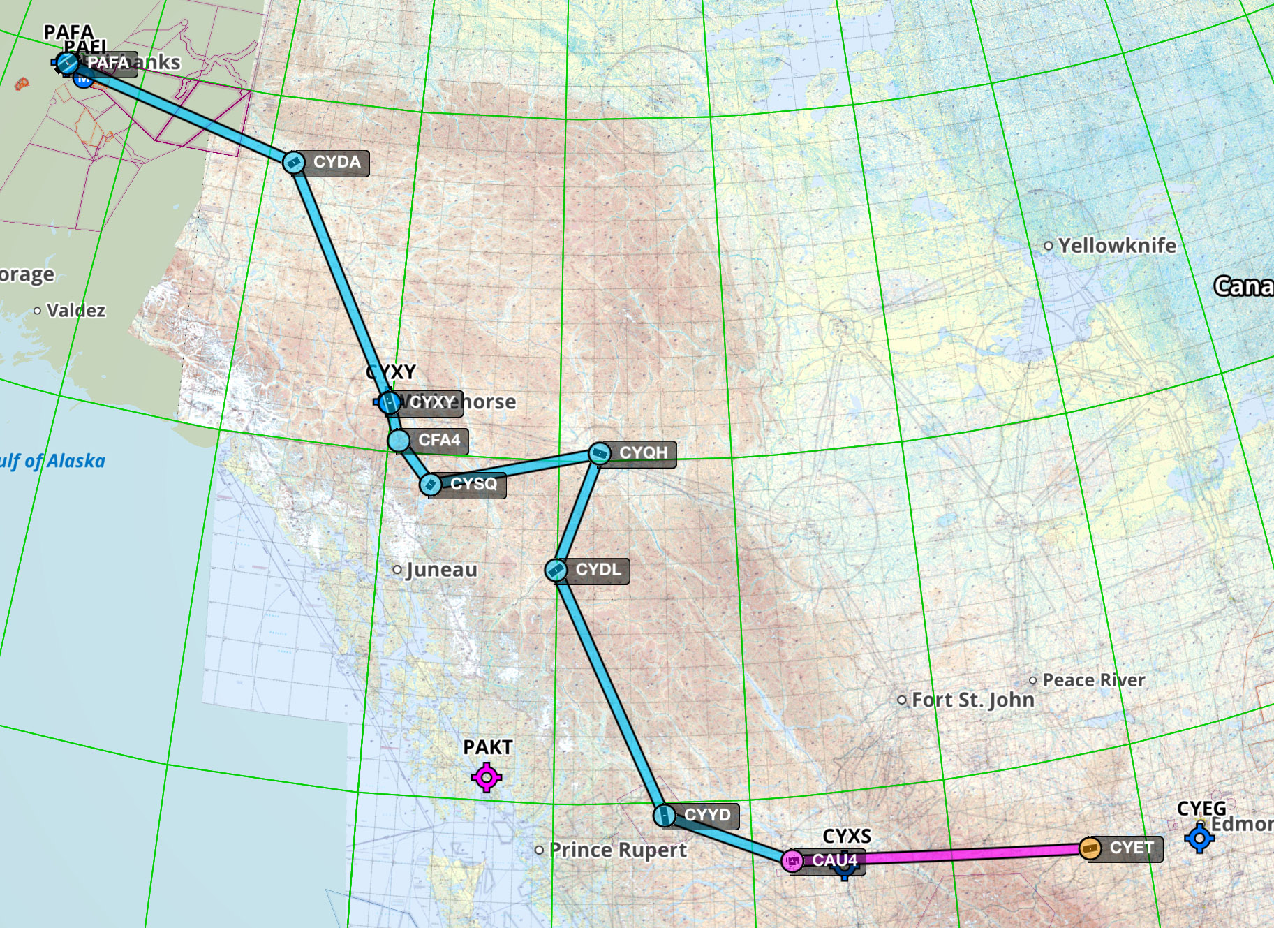
The Cassiar Highway is far more scenic than the Alaska Highway to Watson Lake. There are spectacular mountains, magnificent rivers and distant glacier fields. Flyers are hesitant to take the Cassiar as it is some 365 nm between Smithers and Watson Lake for reliable fuel. Dease Lake is about halfway. It now has reliable fuel. This makes the Cassiar route more comfortable.
CYET Edson A good place to stop before heading to the Cassiar. Lodging and restaurants near the airport.
CAU4 Vanderhoof Good fuel stop. Bypass Prince George and get fuel self serve here. If the card reader gets interrupted, you may see a pending $1000 charge on your account until it clears.
CYYD Smithers Last fuel before Dease Lake. Top off here.
CYDL Dease Lake. Now has fuel. New FBO, Terminal building for toilets, charge cell. WiFi. No cell service. Camped.
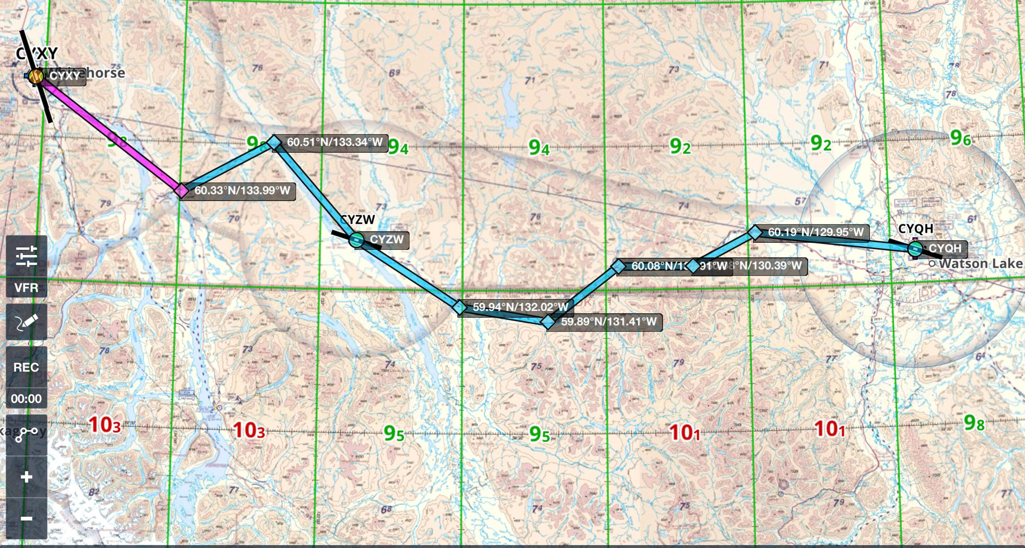
CYQH Watson Lake – Wonky self serve. Talk to mandatory frequency radio operator to reset card reader. Camped.
Dease Lake There is a new FBO at Dease Lake. It is full serve. Text or call 250 617-1482 or 250-771-5911. If they are not at the terminal building they are nearby. There are three scheduled flights a week into Dease Lake doing mining crew shifts. Get fuel during normal hours as the call out charge is high. The ground crew was friendly and helpful. There is no cell service within 100 miles. Make sure your phone is configured to make Wi-Fi calls. Get the code for the terminal building to use toilets, landline to close your flight plan, and electric outlets for recharging. I camped on the field. There are no restaurants or convenience stores in Dease.
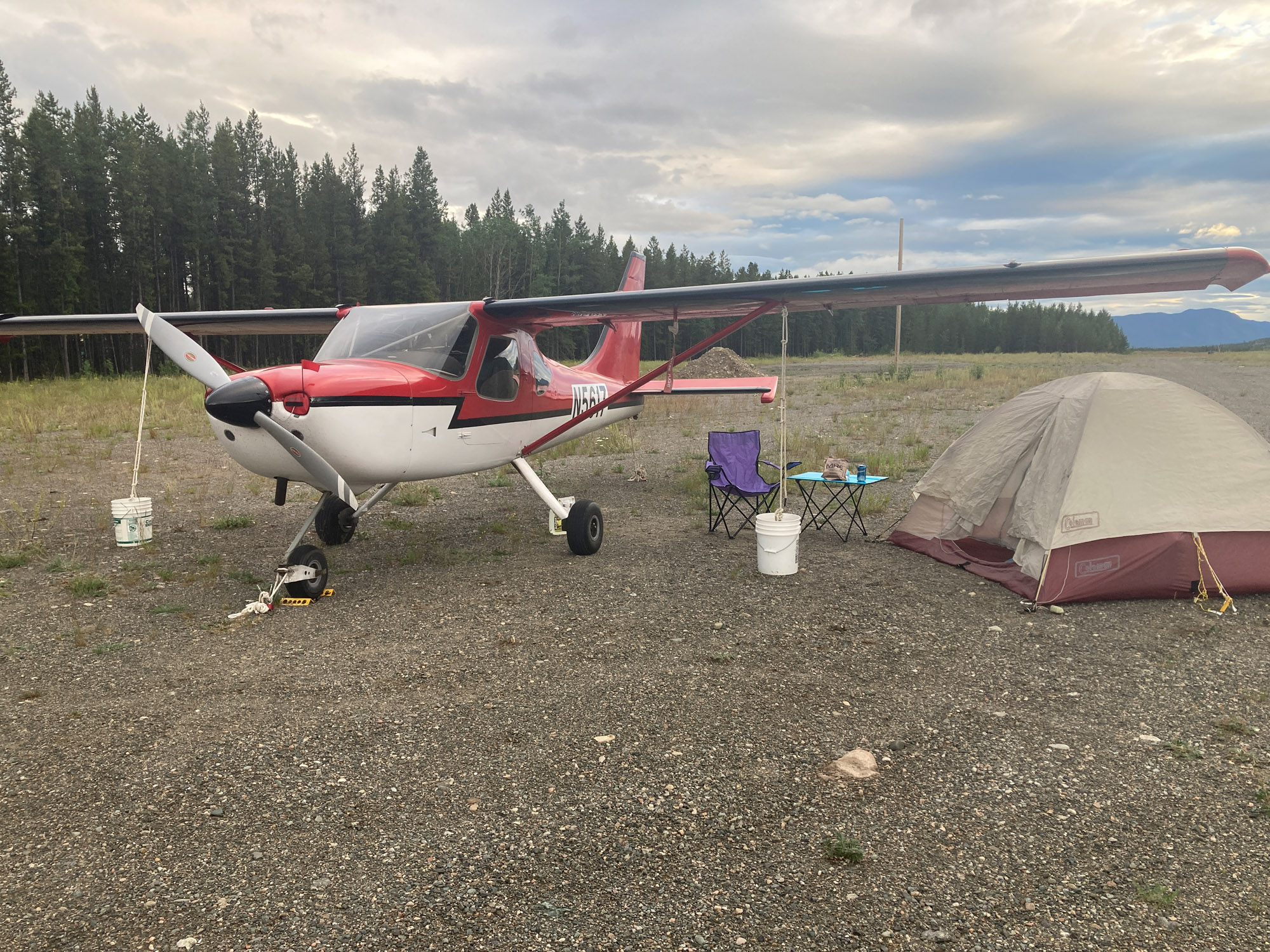
Watson Lake Good camping. Pitched a tent in the pavilion for wind protection. Porta Potty. No water but lake is right there. Wood stove in the pavilion. A pilot tenting in the pavilion in the spring saw grizzly tracks nearby in the morning.
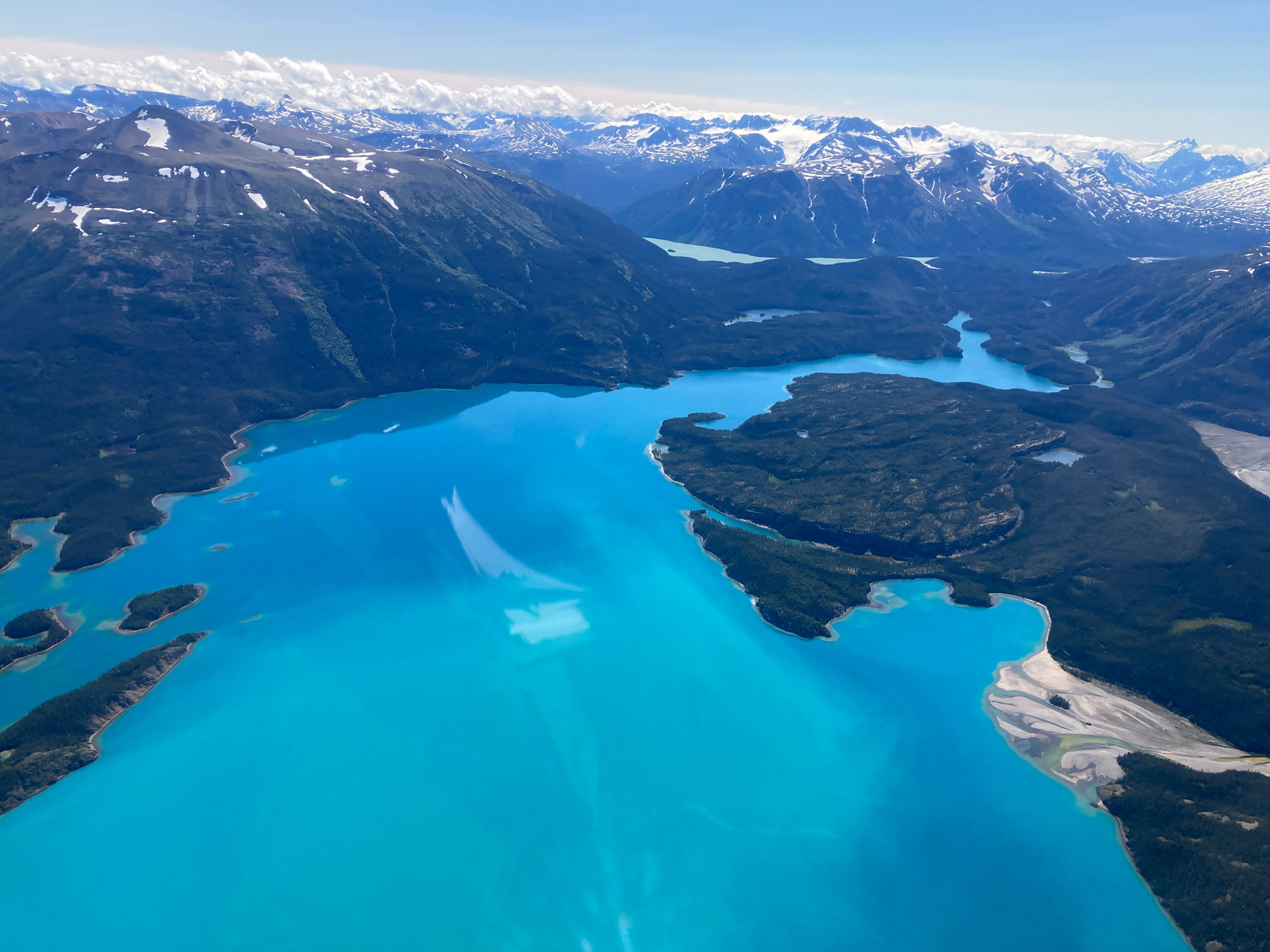
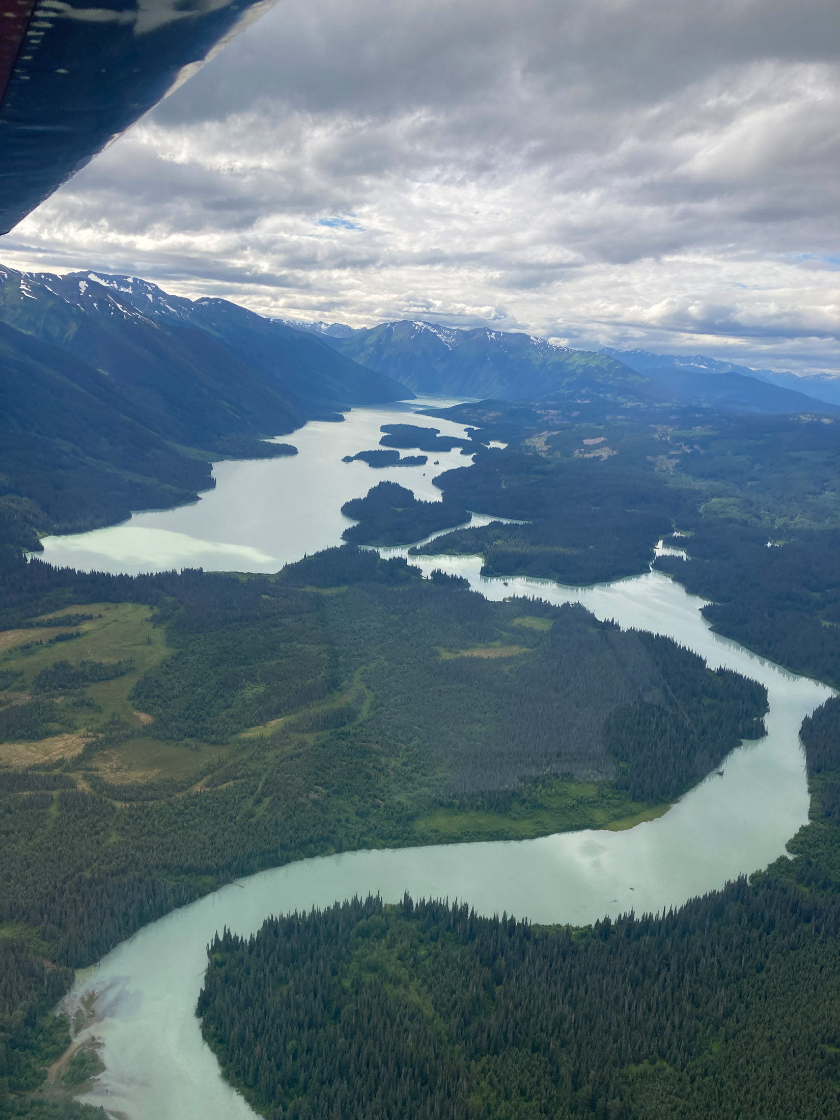
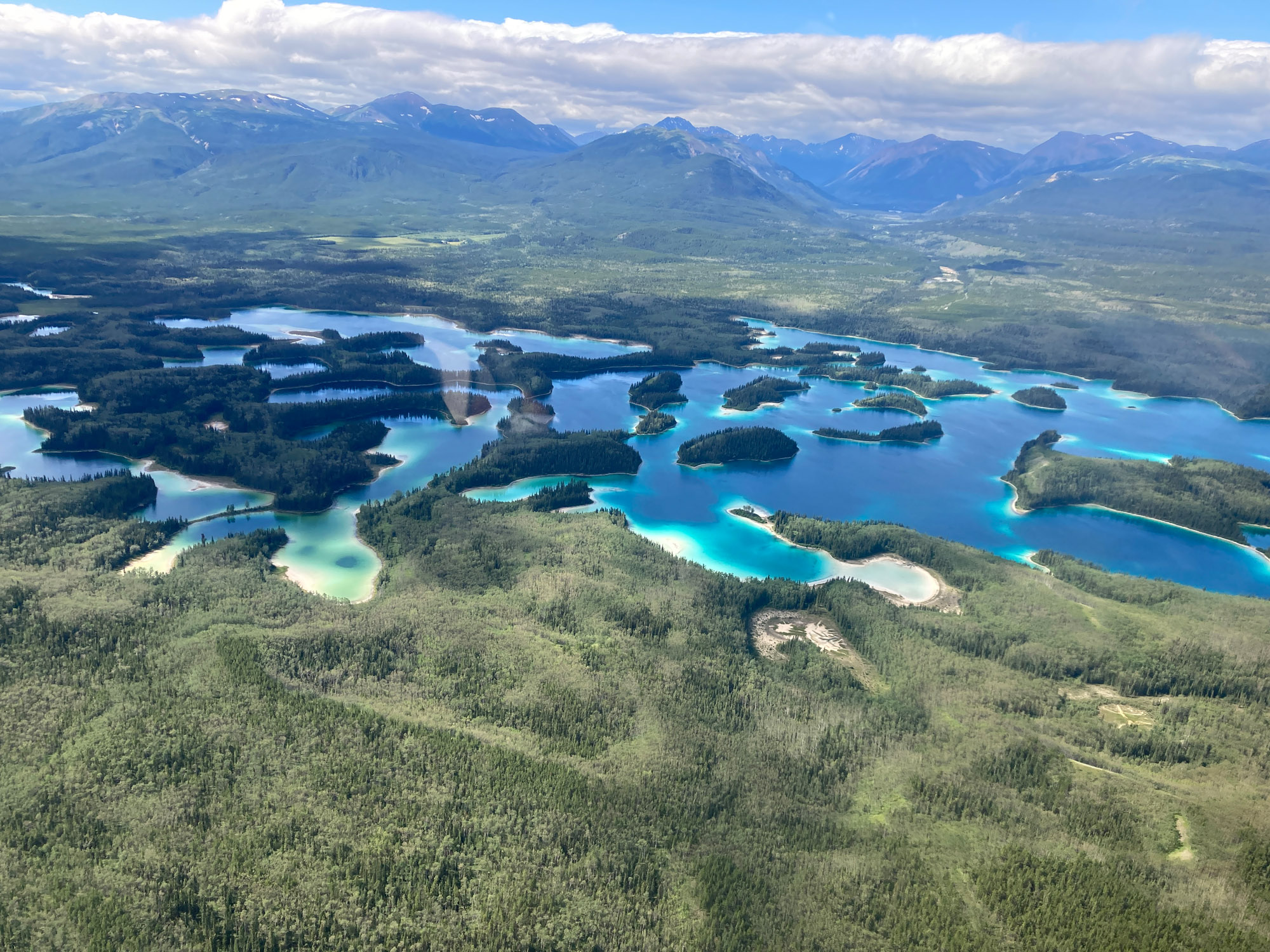
Atlin, BC and a Glacier Flight
Atlin is an interesting off the beaten track place to visit. Departing from Watson Lake, I followed the Alaska Highway through a wide valley. About two thirds of the way, I turned south at Jakes Corner, leaving the comfort of the highway for an emergency landing, and flew over Atlin Lake which is long and narrow. Don’t mistake other long, narrow lakes in the area for Atlin. There is an alternate route over Taku Lake.
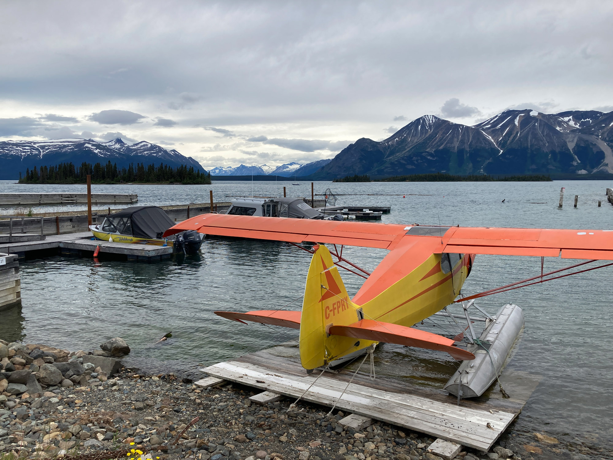
I camped in the grassy area on the south side of the southernmost hangar. Look for a pole crane used to lift seaplanes on/off floats. The hangar owner has a business recovering fabric planes. He loaned me a bucket for an oil change, sold me some oil and let me dispose oil in his waste oil tank. I woke up to 33°F – In the middle of July!
There is no cell service for visitors anywhere in Atlin. There is Wi-Fi in the tiny shelter by the fuel pump that holds the credit card reader, range 10 ft., password on the inside wall, and in town on the street outside the RCMP building. There is an old fashioned phone booth, which takes a credit card, by the market. Town is about a mile and a half walk. I appreciated having a bicycle.
Atlin is rich in gold mining history. The outdoor museum has steam shovels, a screw propelled vehicle and other old equipment.
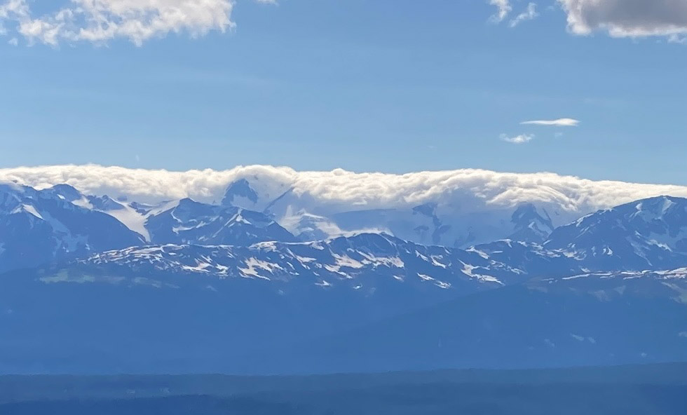
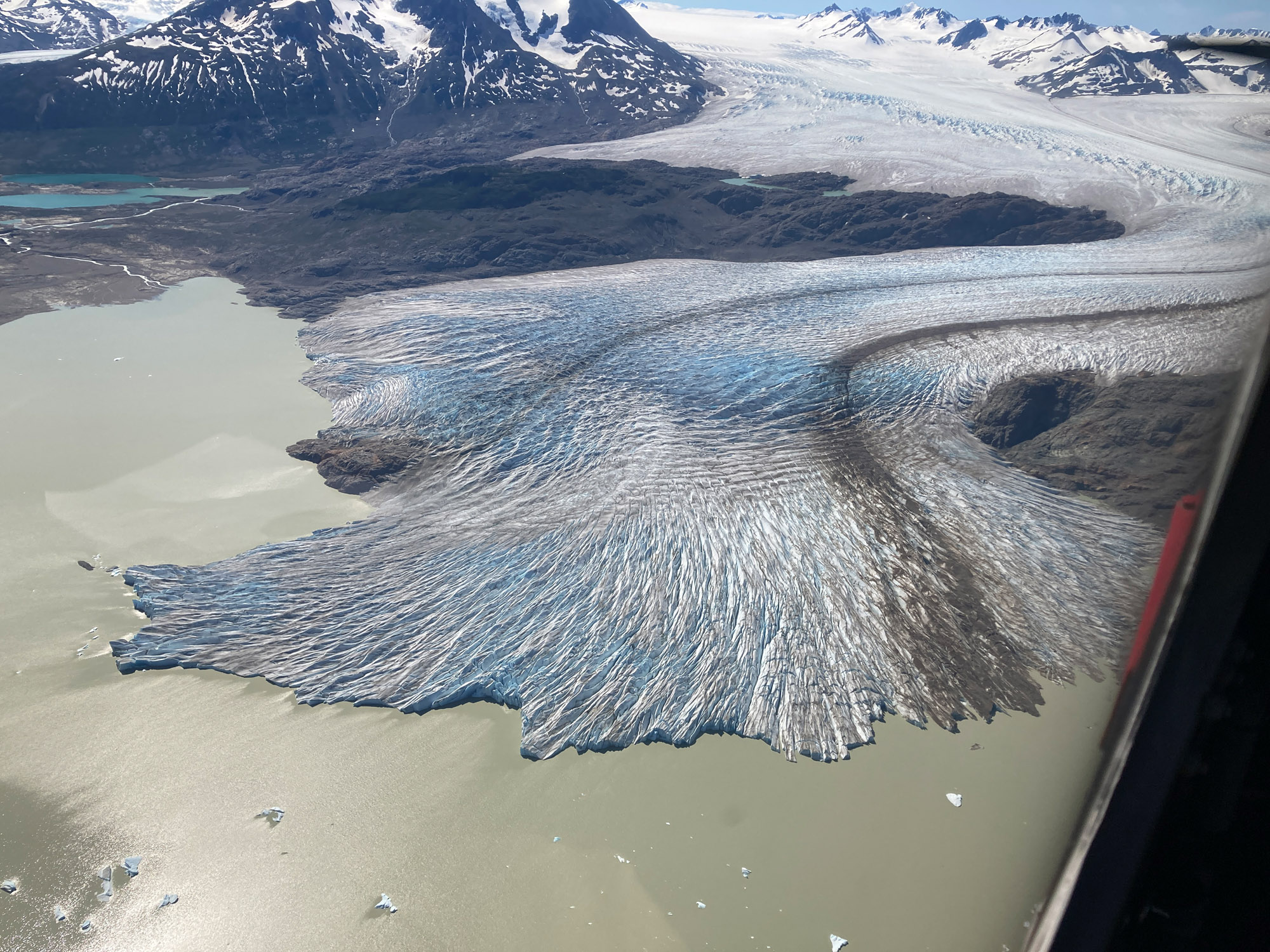
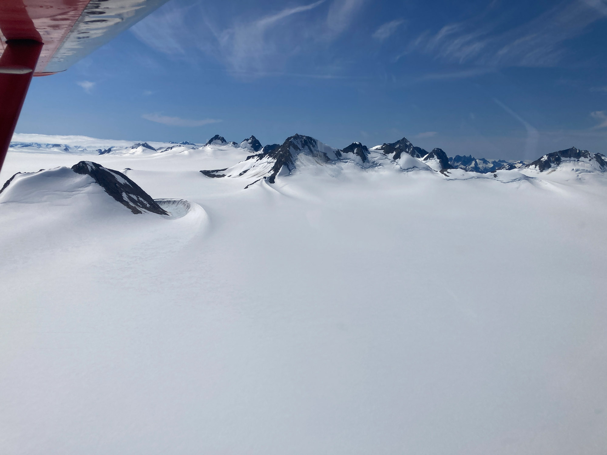
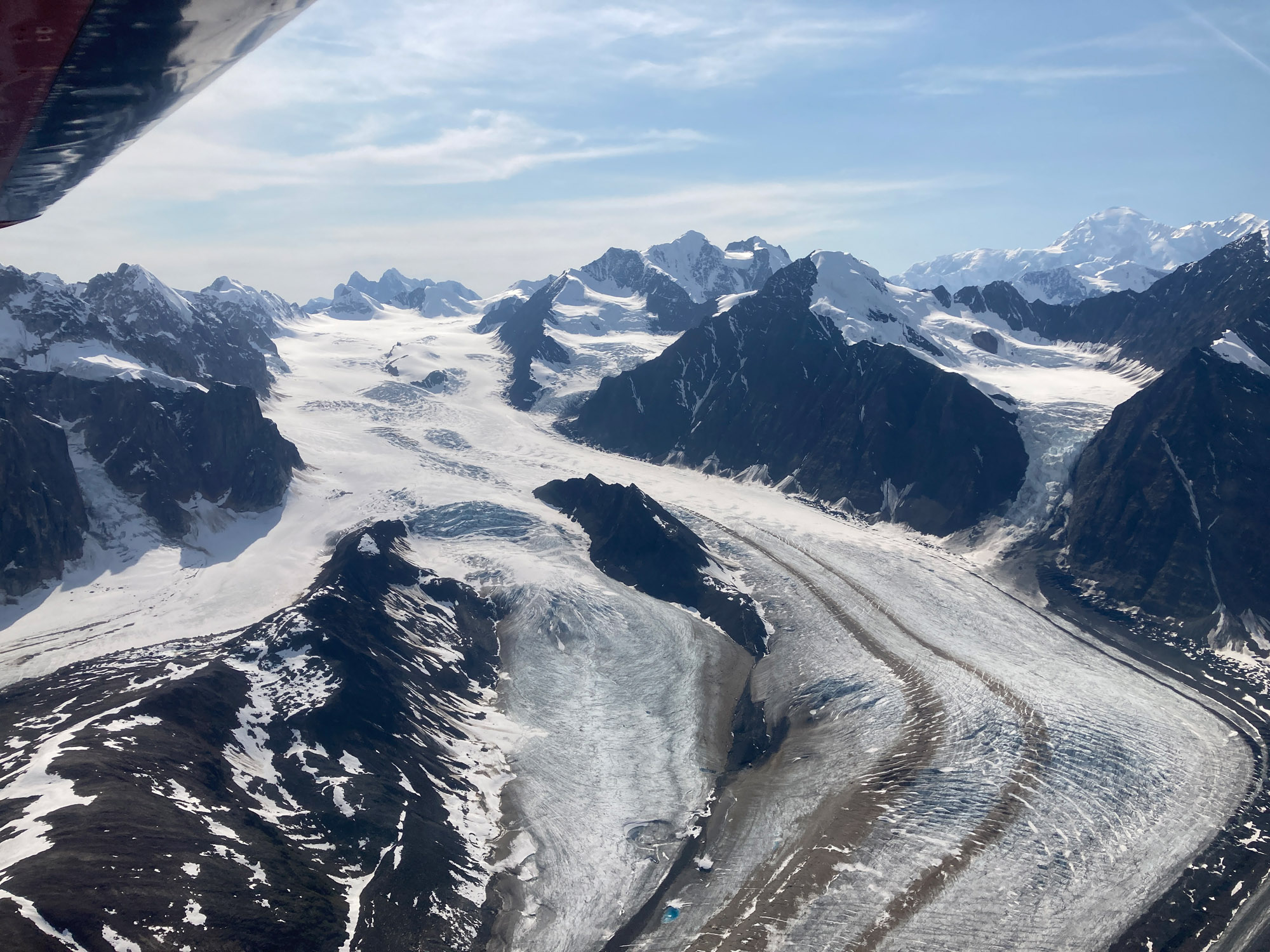
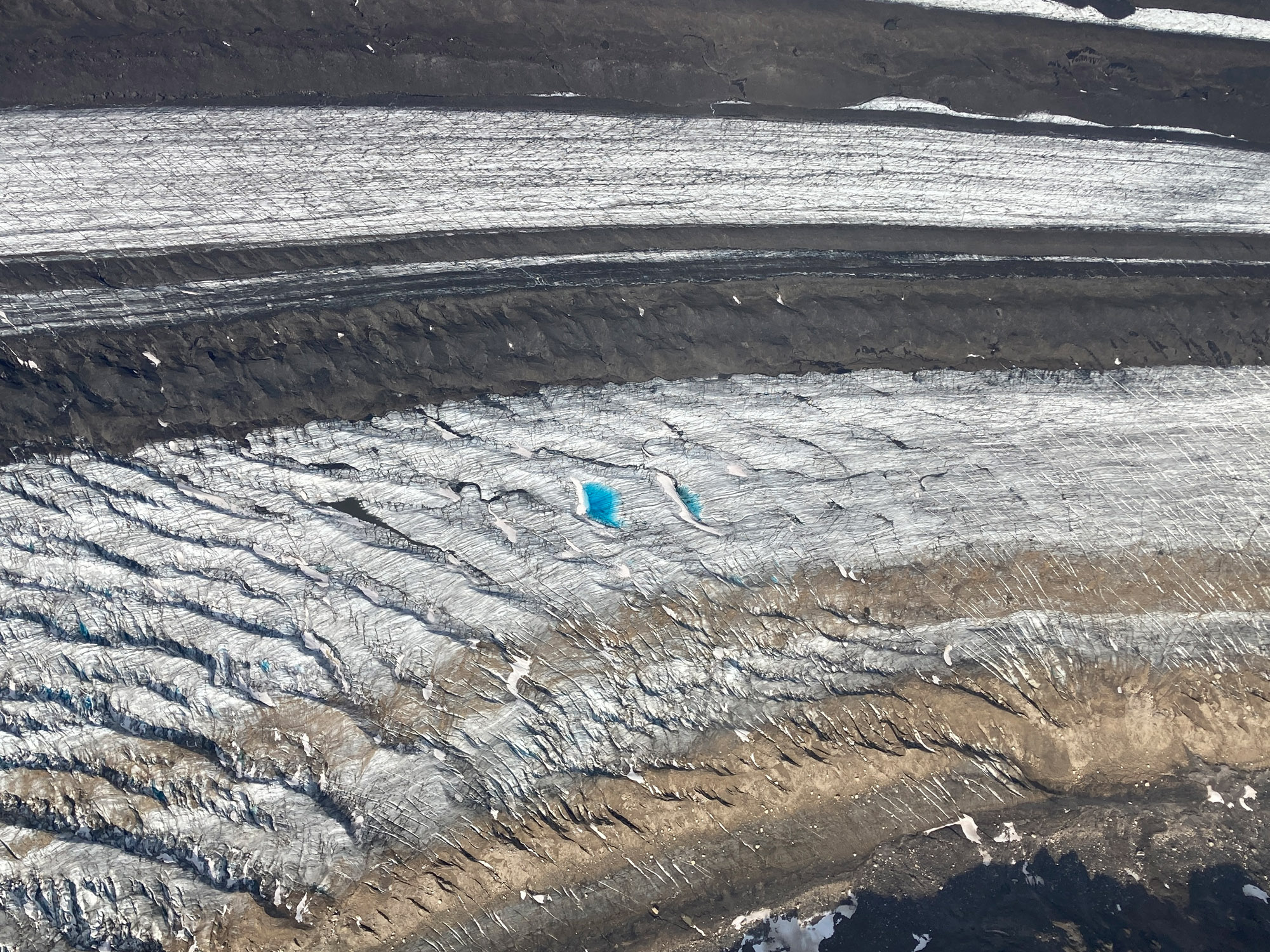
I flew over the Llewellyn Glacier located south of Atlin. What a flight! The glacier gains elevation slowly making it good for someone new to glacier flying. My maximum altitude was 7500’ It is all white with snow and ice – a place where you wouldn’t want to get turned around in. I found it helpful at times to have the map display set to north up. You should stay on the Canadian side of the border although I was told incursions are not uncommon when flying the glacier.
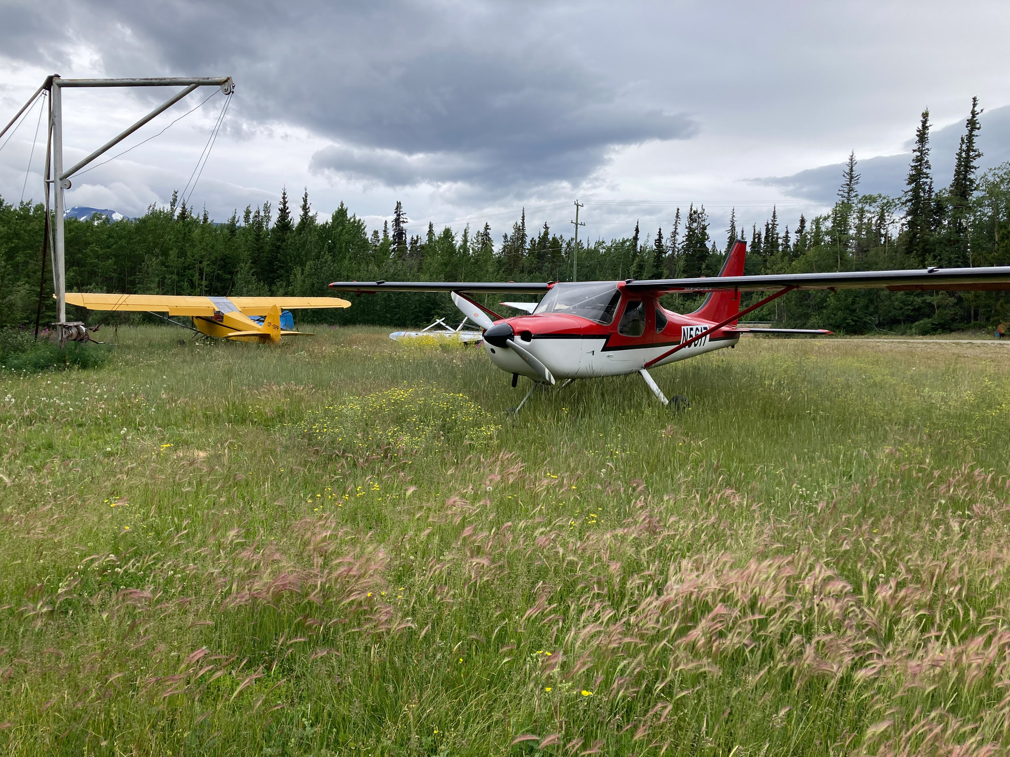
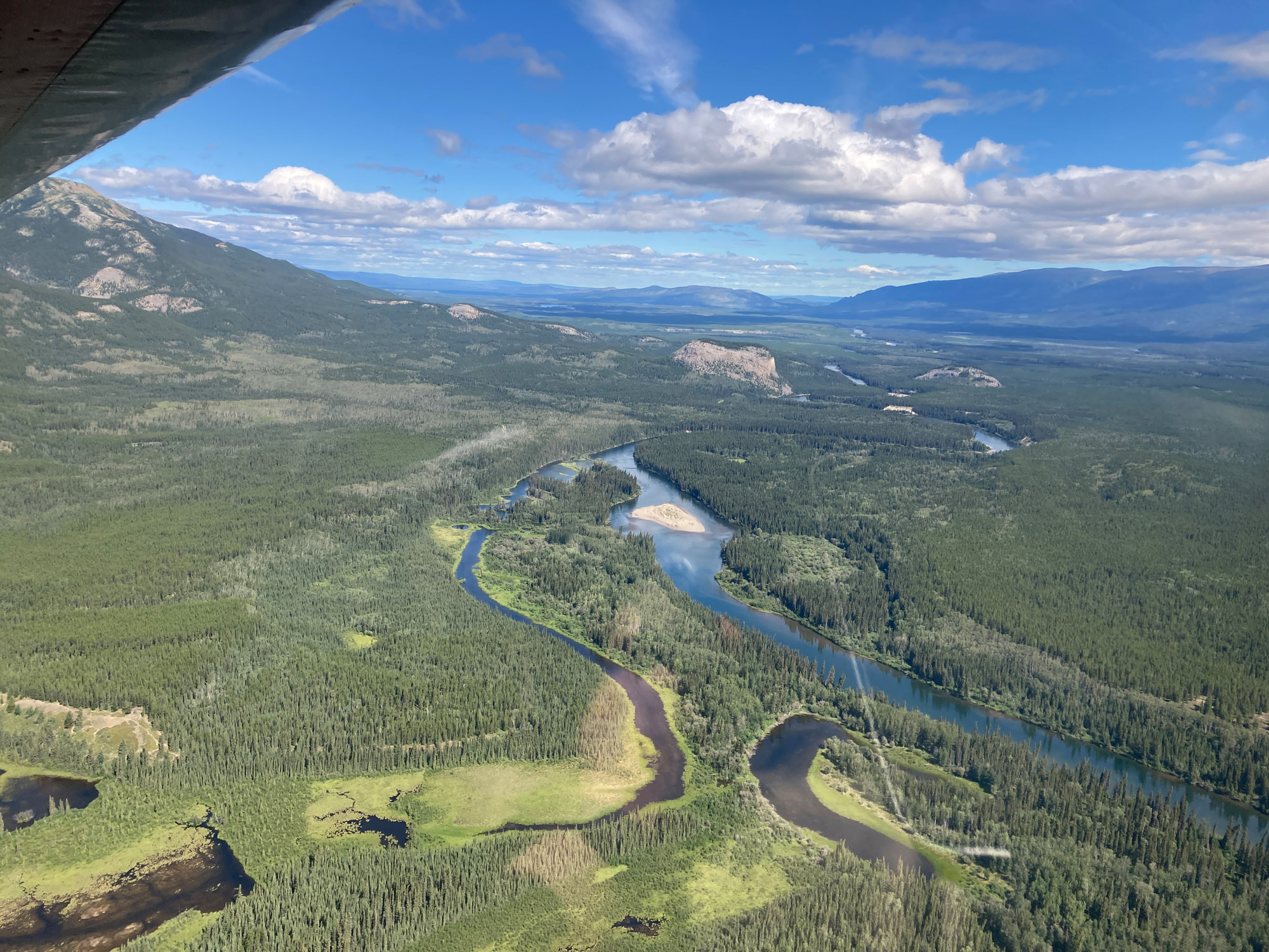
Carcross – Yukon Territory
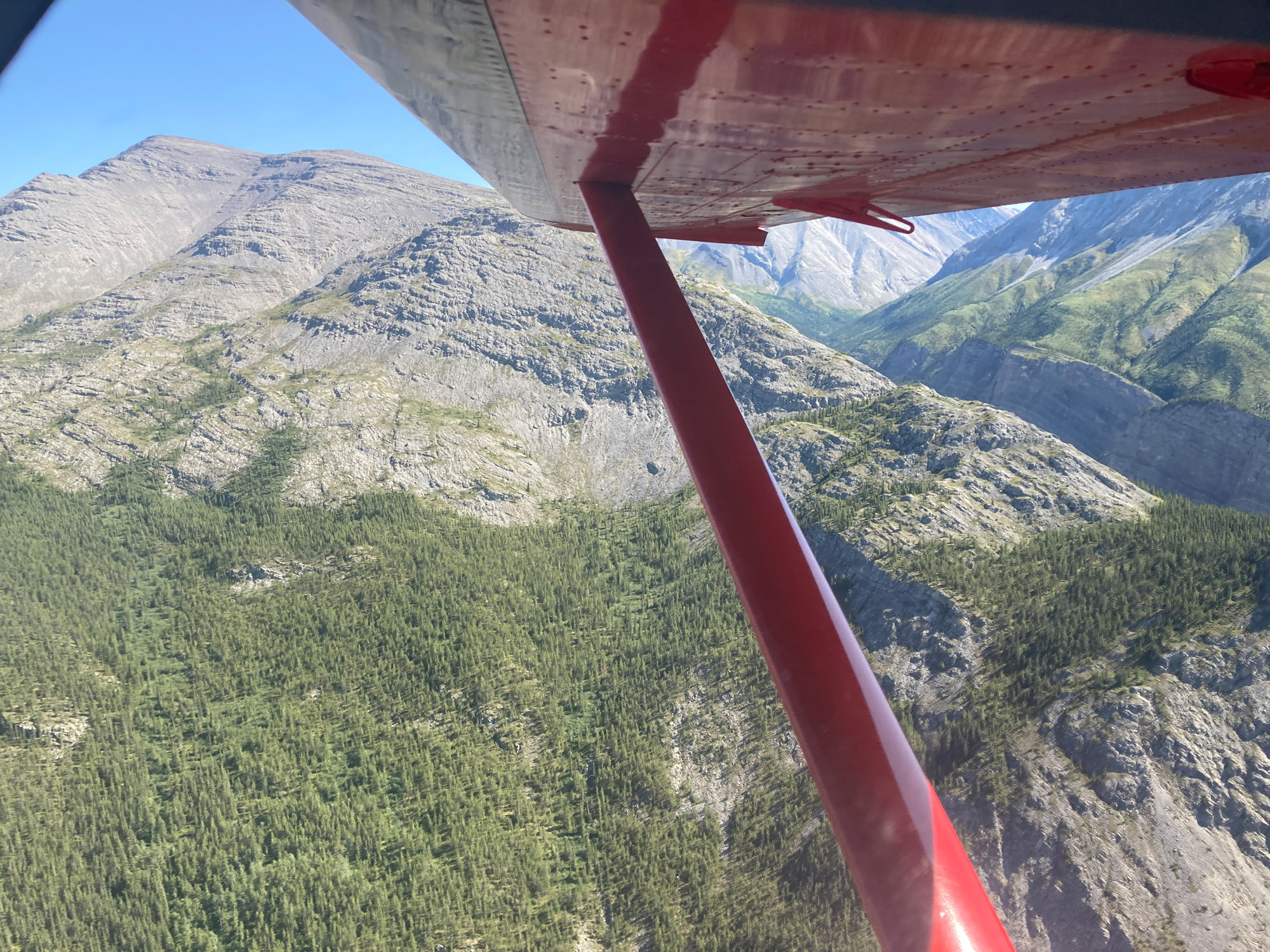
To reach Carcross from Atlin, I cut over from Atlin Lake to Taku Arm to Tagish Lake. This is the recommended route as marked on the Canadian chart. This is a remote area with virtually no roads. If you go down, the recommended route is the first place they will look. This is a pretty flight over lakes at 3000′ between mountains towering over 6000′.
Carcross is a 2200′ gravel strip. The approach is over water until the last moment. There are 3000′ AGL mountains in the area to be mindful of should a go around be necessary. I parked temporarily at the west end of the strip by the highway where it is a half mile to a pleasant café in town. I camped about midfield. Look for a flat bed trailer with an airplane sculpture and a tall metal building.
Whitehorse to Fairbanks via Dawson City
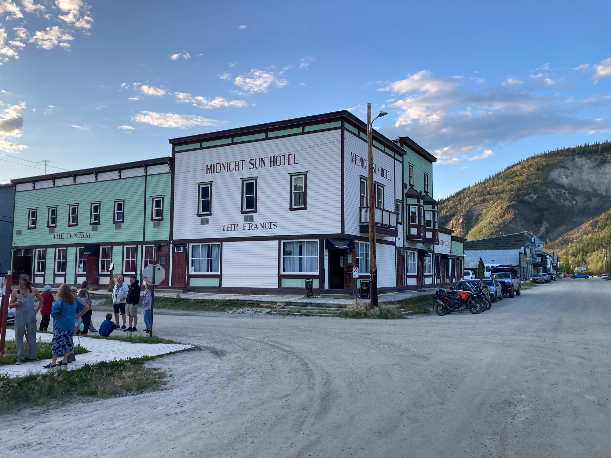
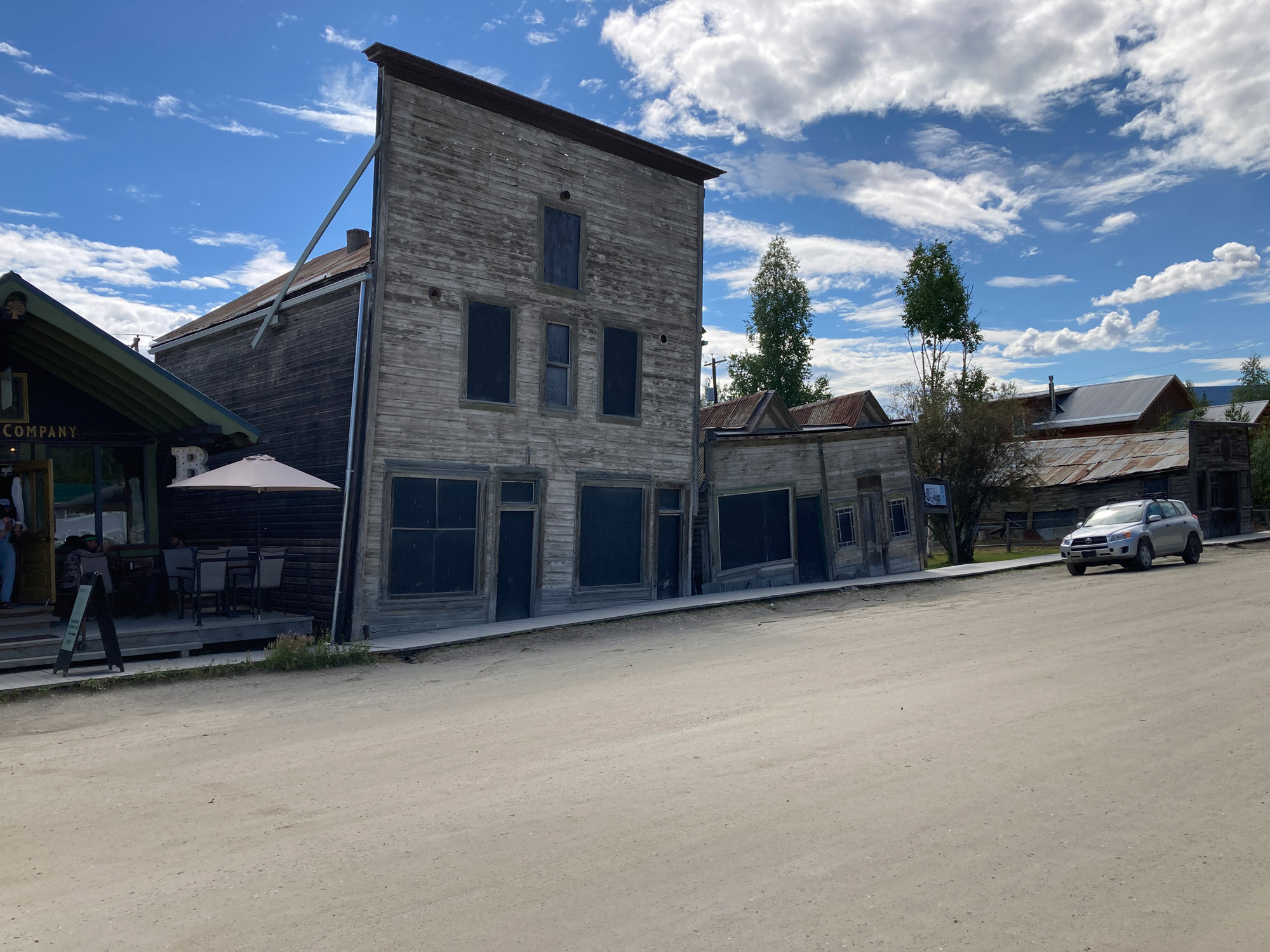
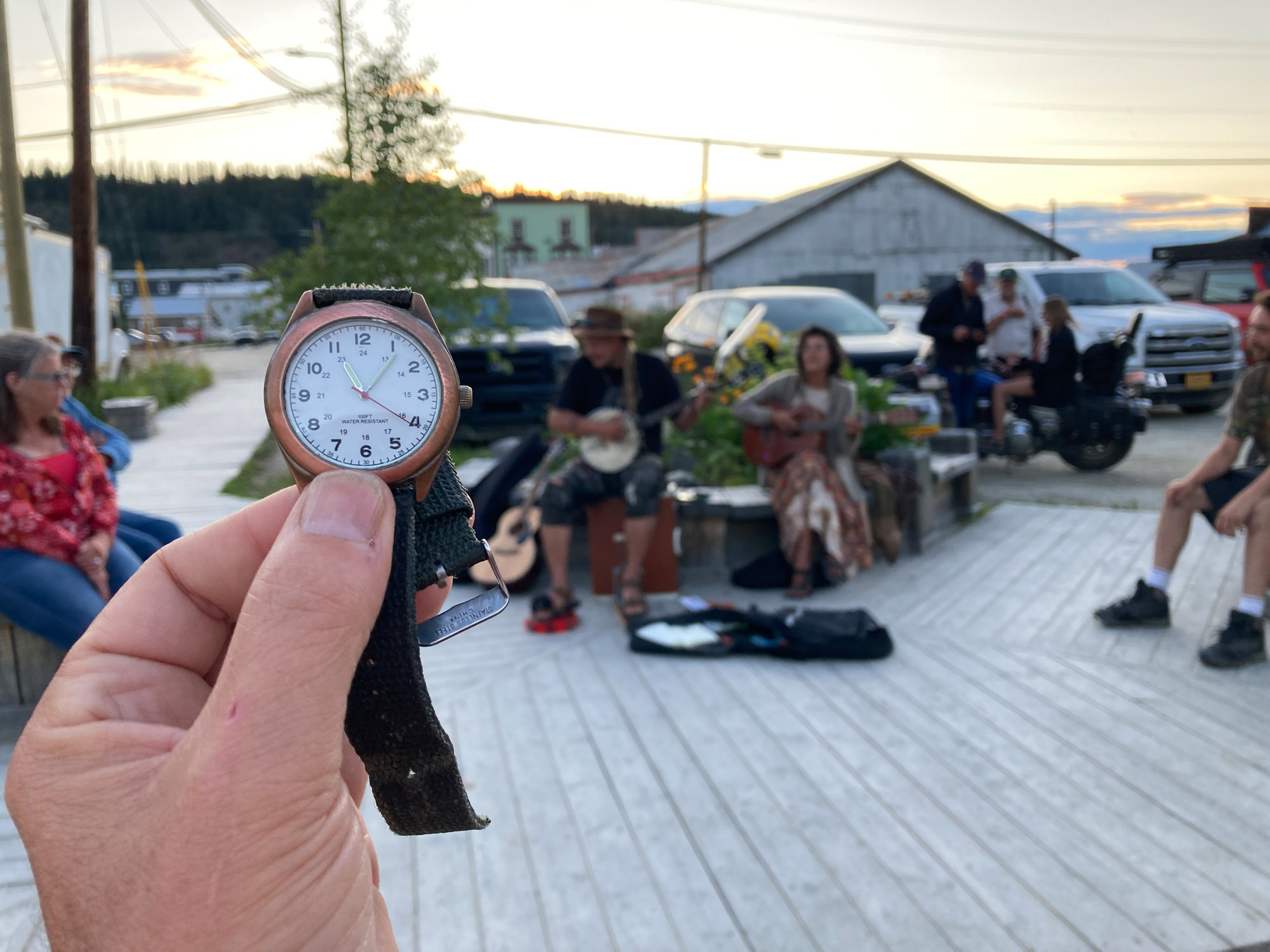
I took this route because Dawson City has a lot of history: the Klondike gold rush; Jack London’s Call of the Wild is set in Dawson, (London’s and Robert Service’s cabins are there), clever mining equipment, original buildings, and a good museum. The town has dirt streets and wood sidewalks because of permafrost. I stayed at the Aurora Hotel and recommend it. There are plenty of things to see and do in Dawson City. Don’t miss a gold mining excursion, Diamond Tooth Gerties, The Pit, a legendary dive bar, and the Sourtoe Cocktail – only for the brave.
Things to know: This route avoids the limited customs hours at Northway. Whitehorse to Dawson City is a 252 nm flight. There are airstrips in between but none with fuel. Braeburn CEK2 is known as the Cinnabon Strip. I didn’t stop. Follow the Klondike Highway all the way. I had to divert from the road several miles into the wild around a wildfire TFR. No smoke.
The Dawson City airport has hills on both sides. A straight-in approach is the norm. Talk to Dawson City Radio for advisories and traffic. Dawson City airport is 8.5 miles from town. It is a $50 US $70 CA cab ride. You may be able to catch a ride on the Eldorado hotel van with a tip to the driver.
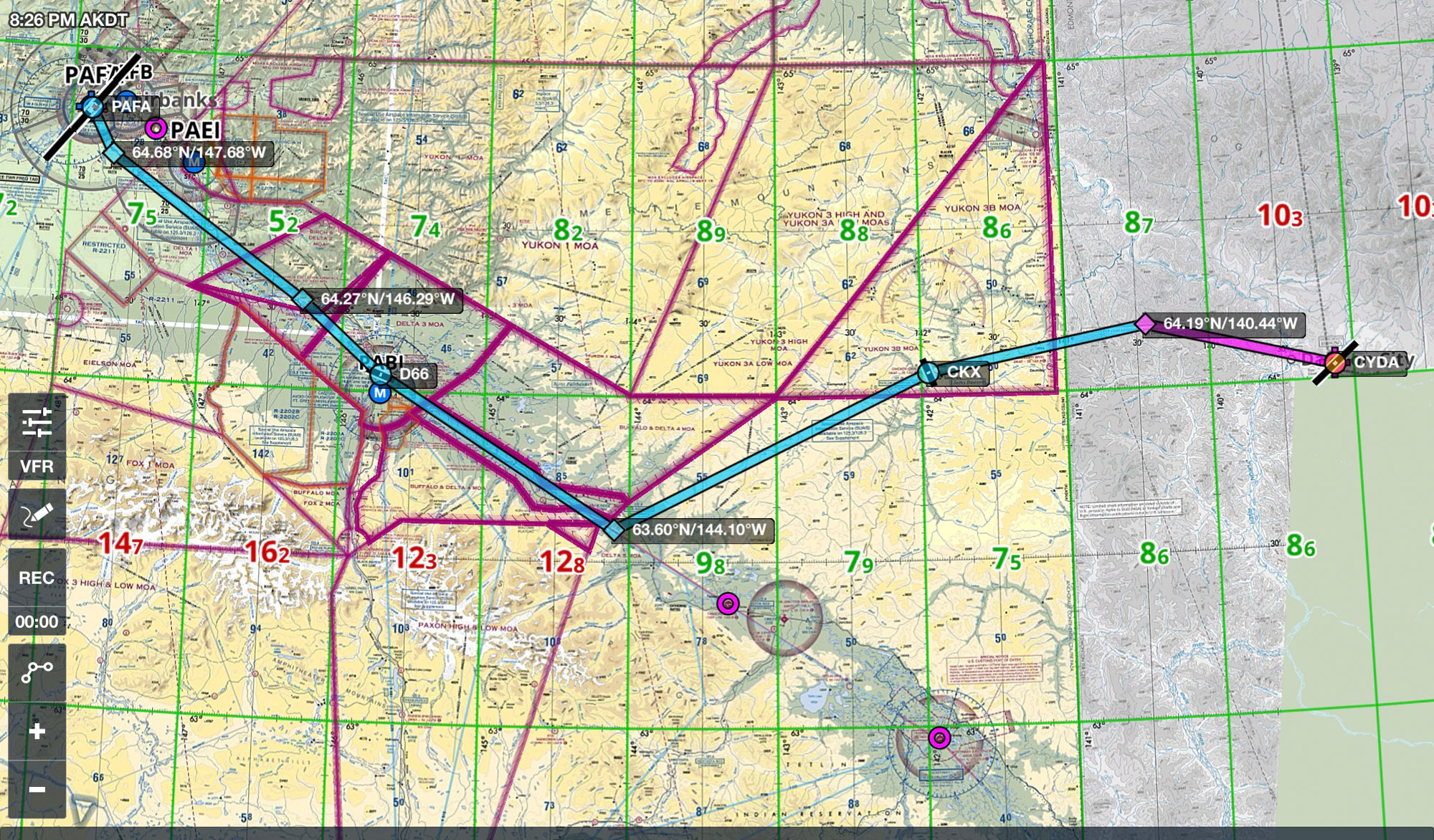
Dawson City to Fairbanks
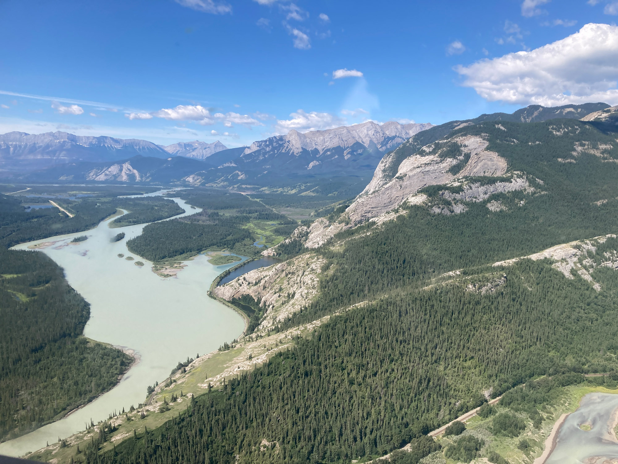
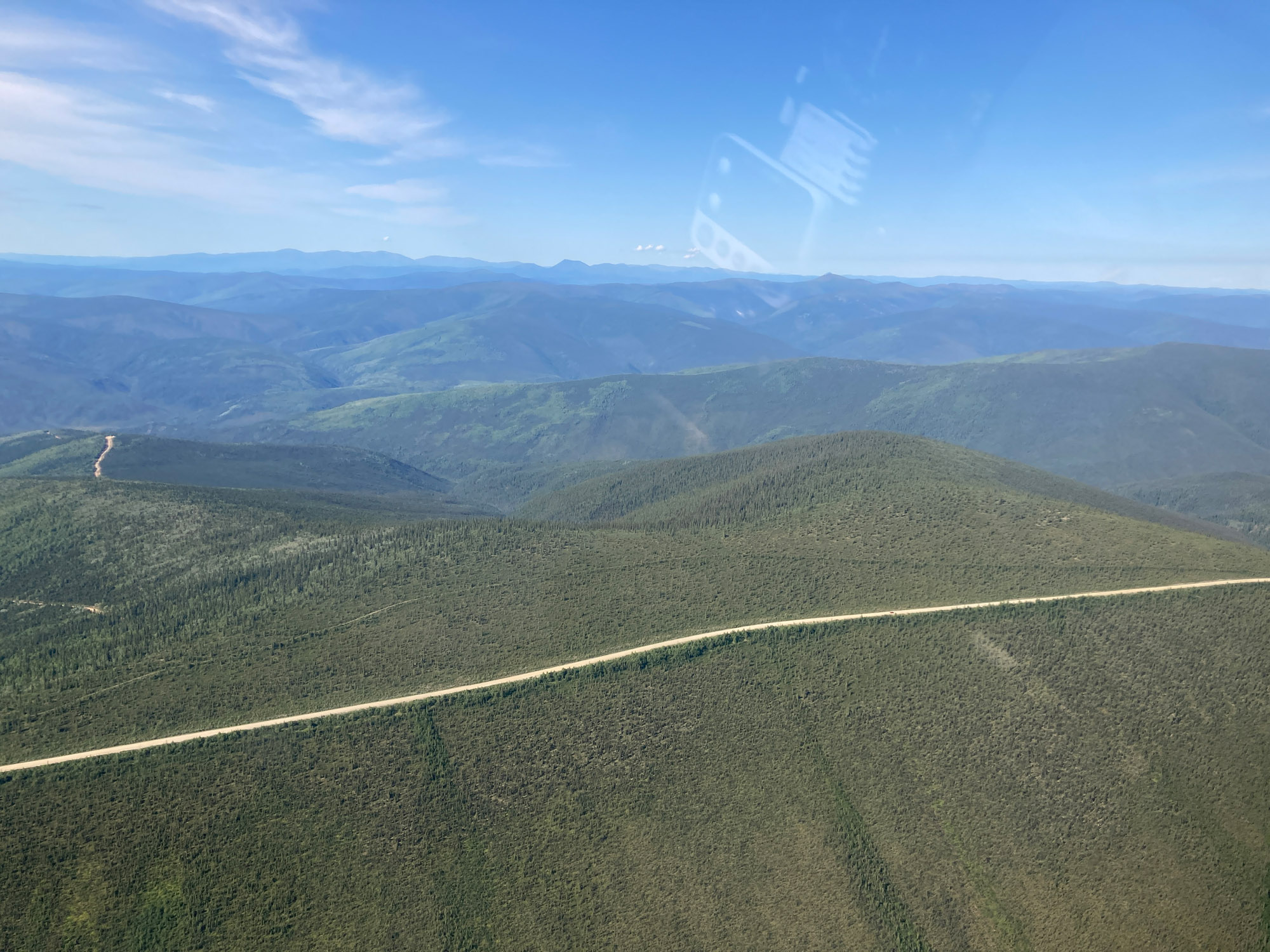
This is a 264 nm flight with nothing in between until you get close to Fairbanks. I departed Dawson City to the northwest and followed the Top of the World Highway to Chicken airstrip CKX. The highway runs on top of the mountains rather than in the valleys. From Chicken, a heading of 227 MAG (268 TRUE) to the Tanana River valley 63.60N 144.10W.
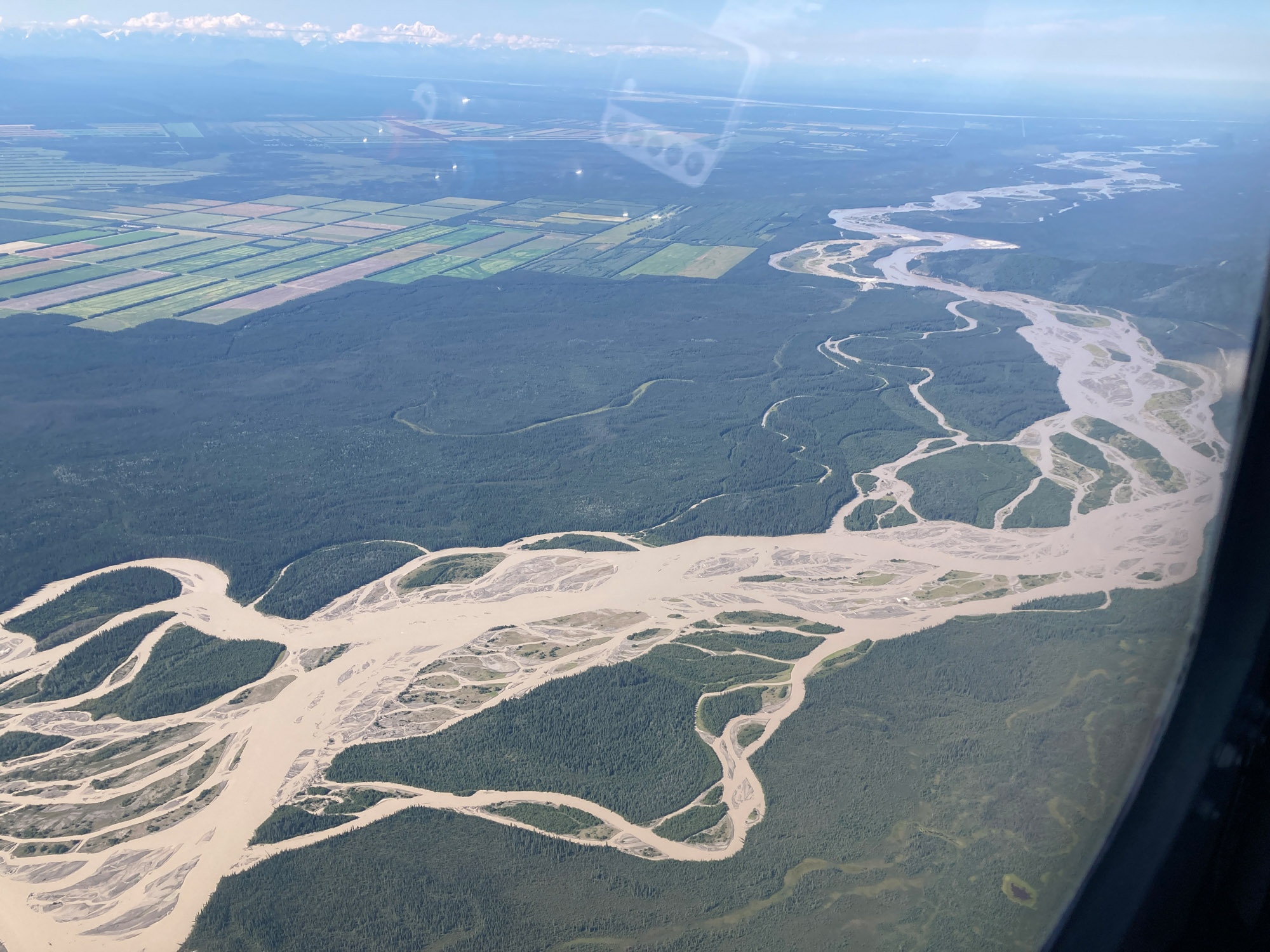
Following the Tanana River valley to Fairbanks is almost a straight shot and easy navigation. Delta Junction airstrip is a waypoint. Watch for Allen Army Airfield Class D airspace. Lots of restricted airspace. This route stays clear of it.
Fairbanks
Fairbanks is confusing with 4 runways all heading 02/20. The 4500’ paved runway is directly in line with a grass runway also called the ski runway. Tell the controller you are new to Fairbanks. They will provide extra guidance.
Be sure to tell the controller you need customs otherwise they will set you up for a general aviation runway on the south side. Customs is on the 11800’ runway on the north side. The customs ramp is not easy to find. There is a pole with a small sign. No flag. Possibly a couple of KC 135s by the area. Customs may not be able to see you. I had to call them. Clearing was easy. Having a 4457 Form signed by a customs officer before departing the US, made the firearm a nonevent. The customs officer was pleasant.
I camped in the aircraft campground at Fairbanks. Picnic table, fireplace with wood, hot showers, outhouse, 2 bicycles (one had a flat) and shaded campsites. Shade helps as it can be hot with 20 hours of sun. Don’t camp facing west without shade. There is a good pizza restaurant on the field 1.1 miles from the campsite- a long way in the heat. The northernmost EAA chapter meets there. It is a short bicycle ride from the campground to a supermarket and stores.
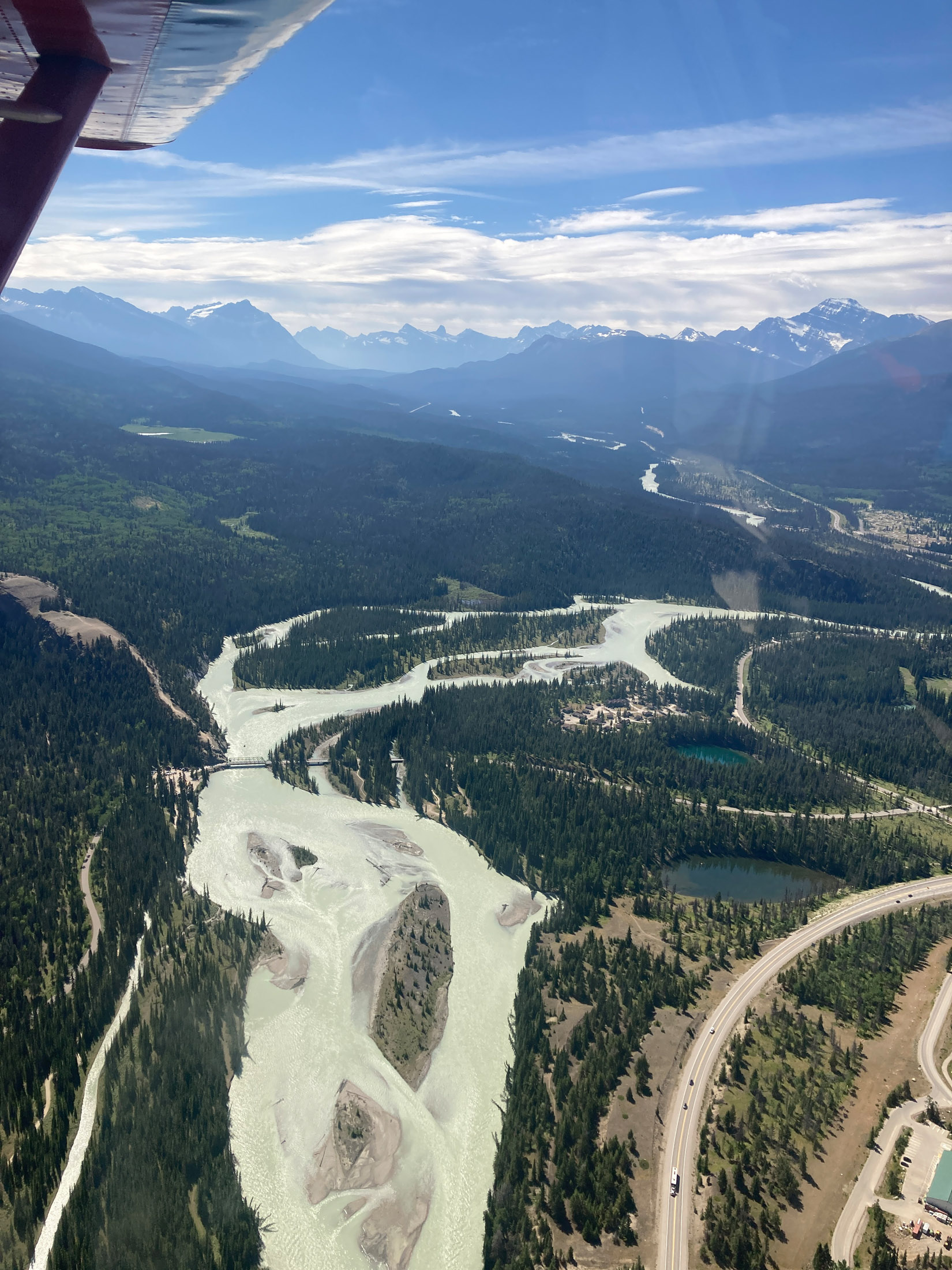
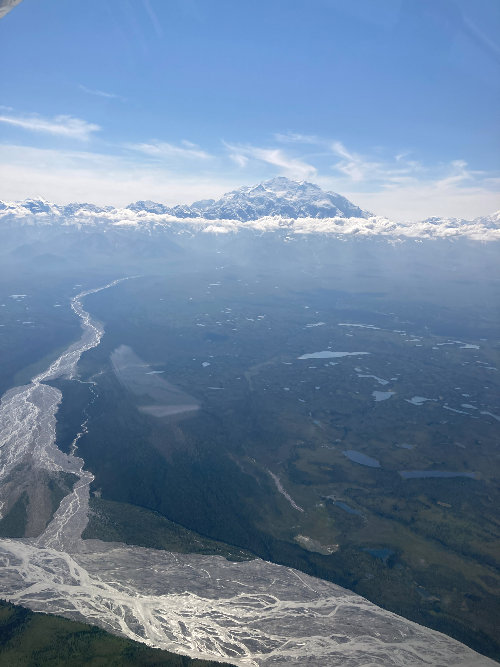
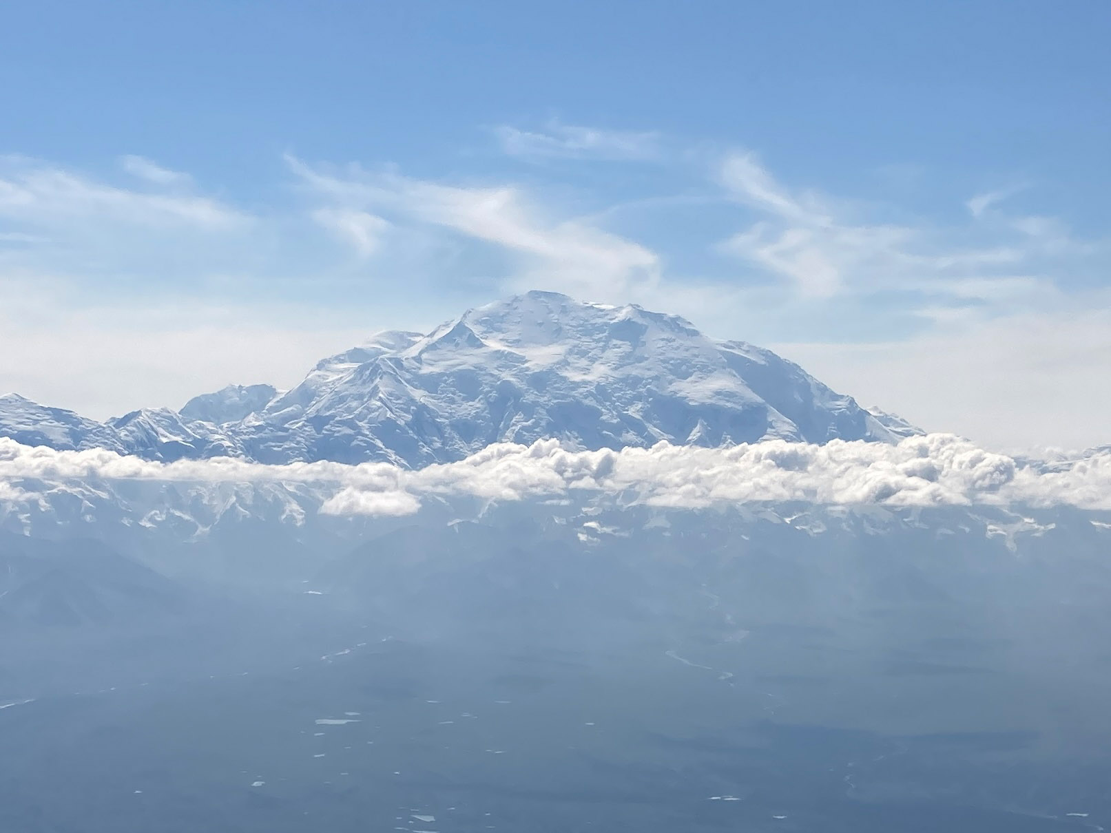
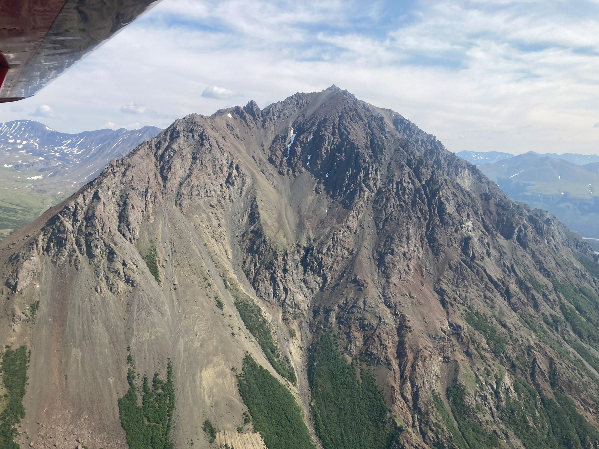
Mt. Denali
From Fairbanks, I flew to the north side of Denali where the rare clear day view was extraordinary. There is nothing like flying at 8500′ next to a 20,000′ mountain. The north side of Denali is remote. Watch the weather behind you when flying from Fairbanks in case you have to turn back due to weather ahead or east. I wanted to fly around the south side of the mountain and up a glacier. I went to Healy River (PAHV) for fuel. Healy is a busy airstrip due to tour flights and being the only airstrip with fuel between Denali and Fairbanks.
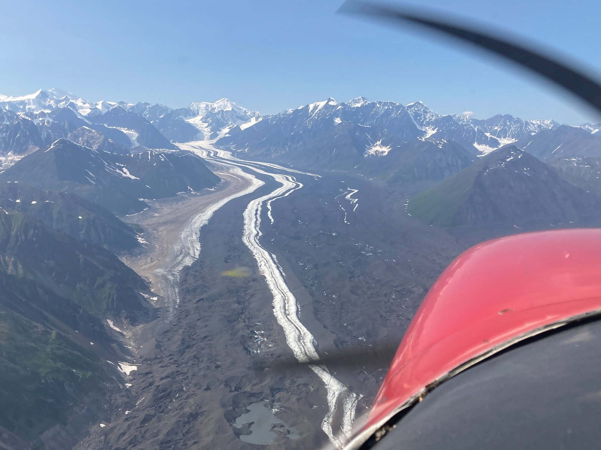
There are lots of tour planes flying glaciers at Denali and no ADS-B. A tour pilot explained the procedure. They use reporting points overlaid onto ForeFlight to state position and intentions. Although air-to-air ADS-B may show some traffic, knowing intentions in the narrow confines of a glacier is important for safety. There are frequencies by sector. I flew the Eldridge Glacier. The scenery gets more and more spectacular. Be aware the terrain rises deceptively and narrows.
McKinley Airstrip (PAIN)
Next I went to McKinley airstrip to visit Denali National Park. No permission is required to land there. It is a gravel strip not visible when landing to the north until on final. Note RH pattern for 34. The local practice is to fly straight in with a dogleg due to terrain. Make a dogleg when departing south between the hills. There were no aircraft other than two aerial survey planes temporarily tied down and a tour helicopter landing and taking off once.
Transient parking is just north of midfield. I didn’t like that location for camping due to openness and rough ground. I camped just south of midfield where it was grassy and sheltered by trees. There were wing tie-downs grown over. There is a path from the airport to the Denali Bus Center. From there I took the Tundra Wilderness Tour (more wildlife than the Natural History Tour) and saw five grizzly bears, caribou and Dall sheep.
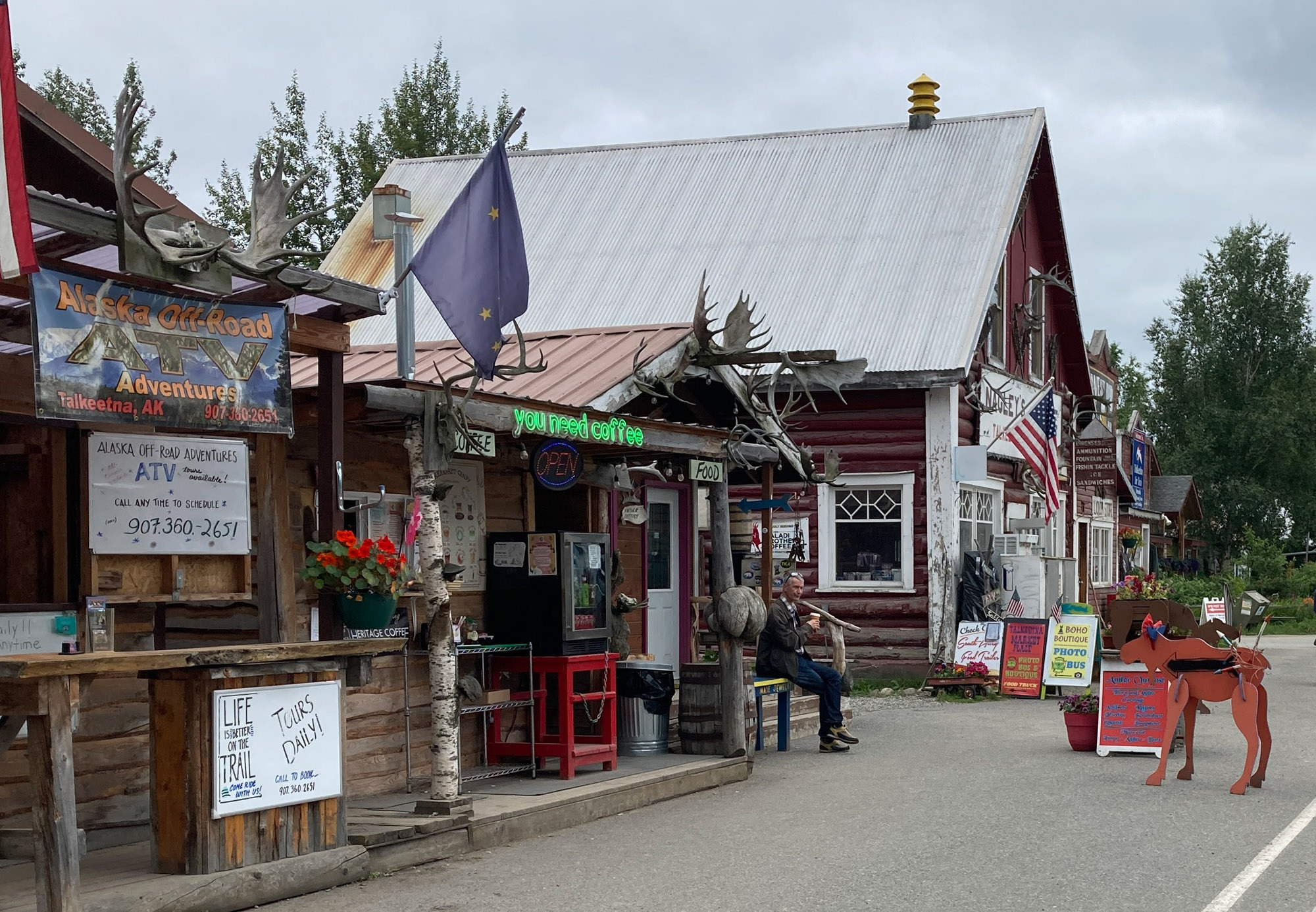
Talkeetna (PATK)
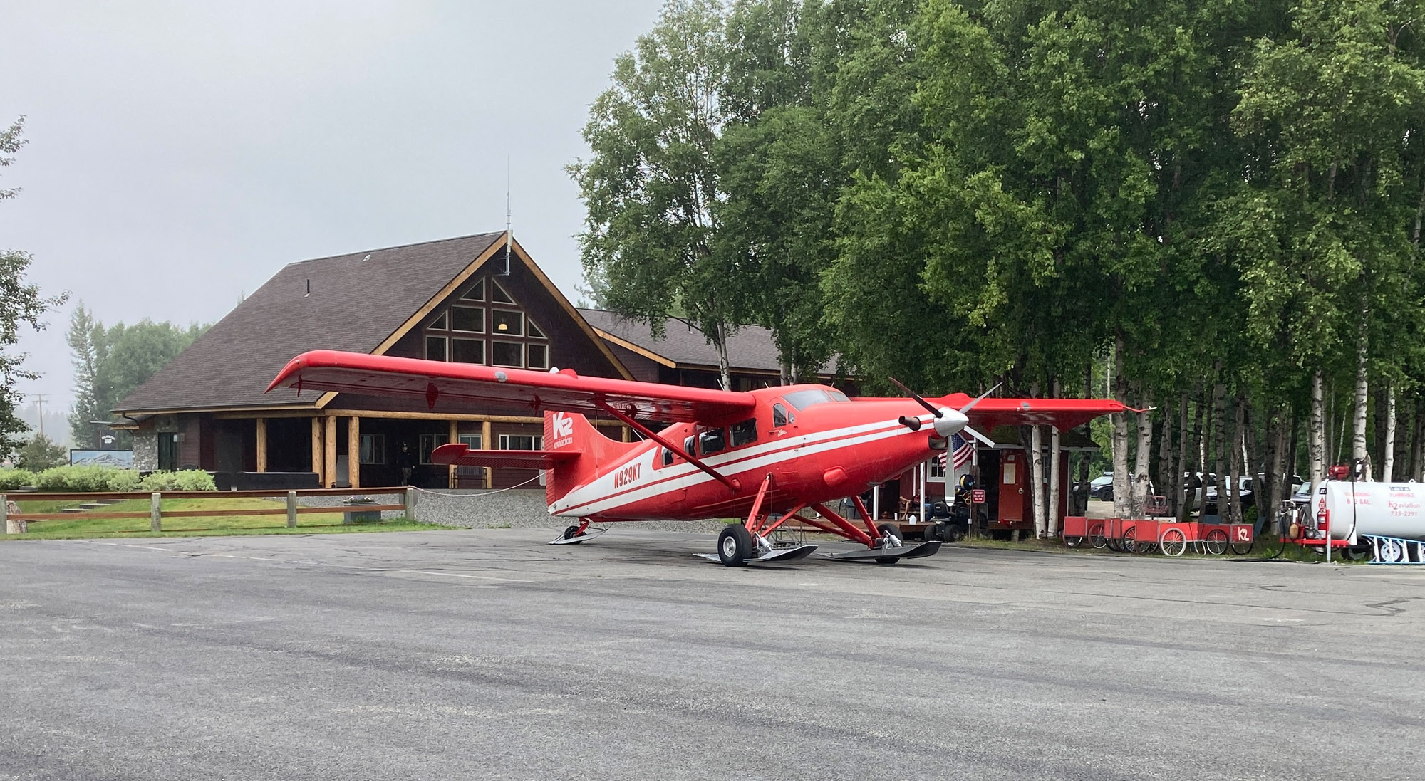
Talkeetna has many restaurants and shops within walking distance of the airport. I camped behind Sheldon Air Service. Officially no camping is allowed but the airport manager was nice about it. I went to Talkeetna a second time when diverting due to weather. Sheldon people, pioneers bush flying service, were helpful with the local weather patterns. He moved between weather cams, satellite cloud views and radar like a piano player. Sheldon provided a ride to the Swiss Alaska motel which is close and reasonable. There is a path through the woods to town. K2 Aviation has a building with a lounge, power outlets and rest rooms for Denali climbers and tours. The building is open extended hours.
Remember the days when you walked into Flight Service and got a briefing? I did just that in Talkeetna. A nice experience. Talkeetna has Flight Service on the field. It is manned by knowledgeable government employees who welcome an in-person briefing like the old days.
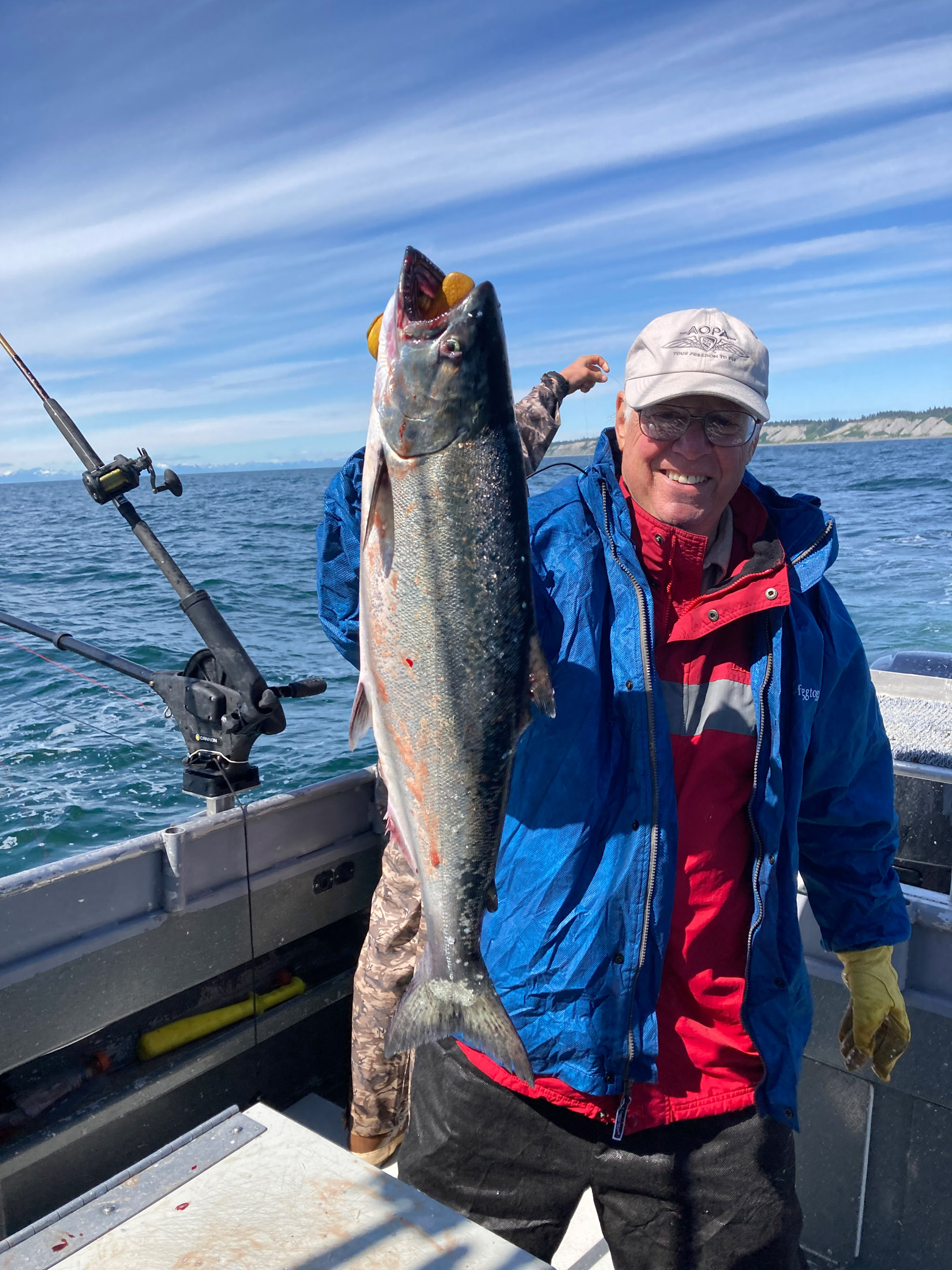
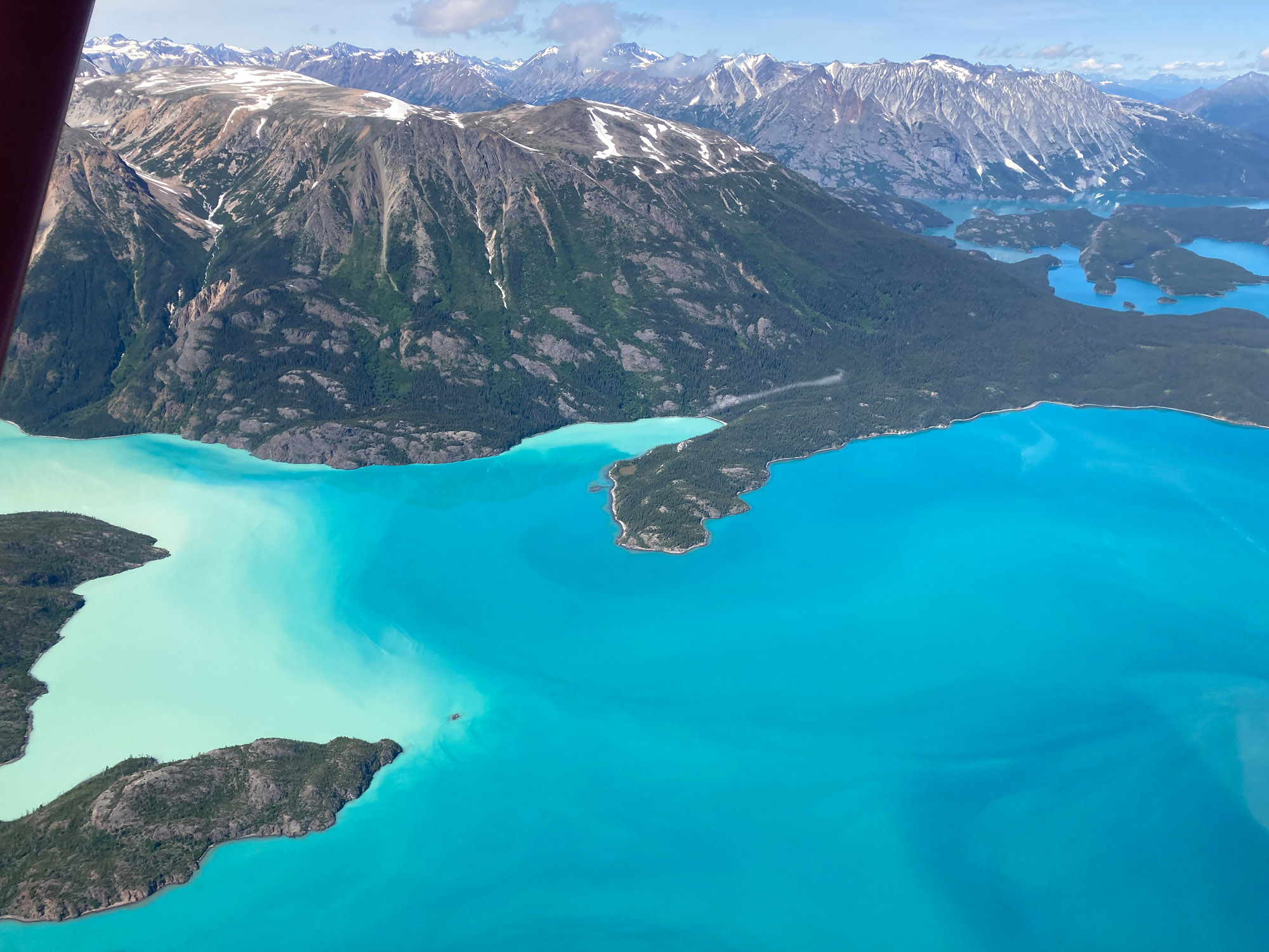
Homer (PAHO)
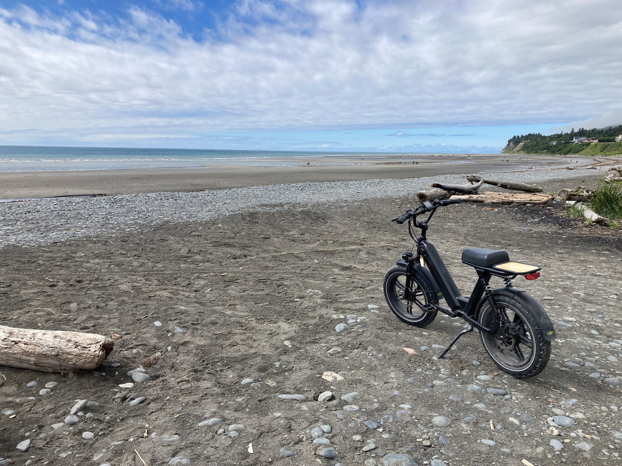
Homer is definitely worth a visit. The fish picture is to encourage you to fly there. I caught my limit in Halibut and King Salmon. The Driftwood is a reasonably priced motel (for Homer) in the old section. I recommend it. They located a last minute space on a fishing charter and booked it for me. I rented an E-bike near the hotel. Go to “The Spit”; a spit of land with shops, boats, tours etc. Costa’s taxi is more reliable than others. Transient tie down $10/day, first day free. Leave money in an envelope or pay online. Note the snow on the mountains.
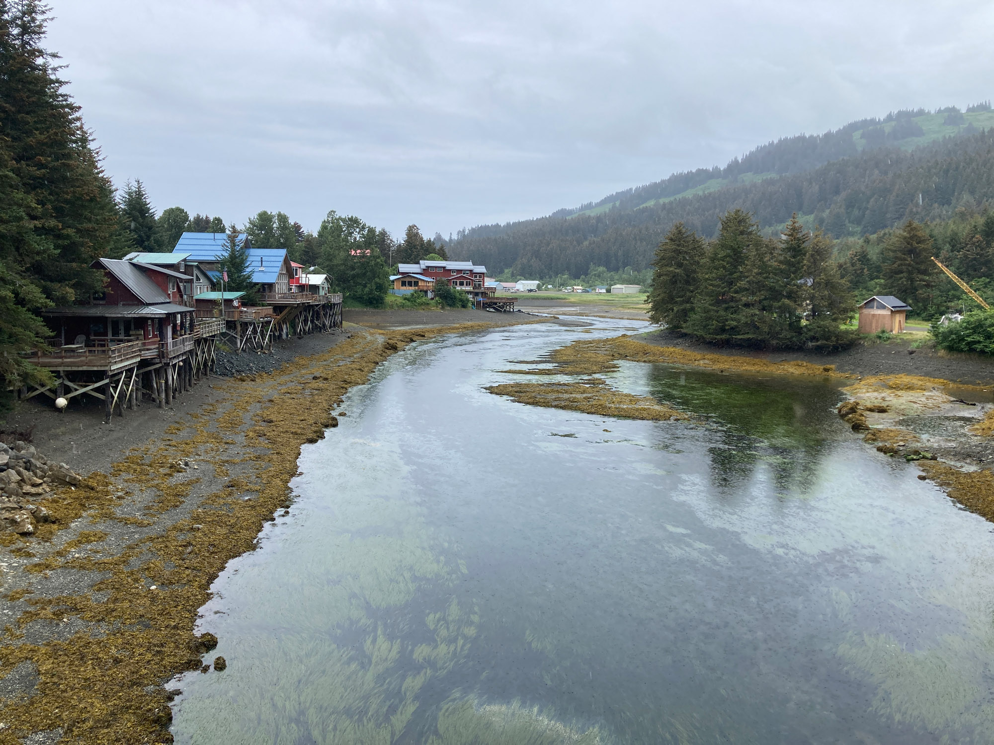
Seldovia (PASO)
Went to Seldovia for a side trip. The village was founded by Russians. The Russian and Native Alaskan influence can still be seen. A good stop. Walk to town. Not too touristy. There are hills to the south. Normal practice is land on 16, depart on 34. Rain made it difficult to judge height on approach to the gravel runway which blended into surrounding gravel. I used a night landing technique and was rewarded with a light jolt before expecting it. Camped on the field.
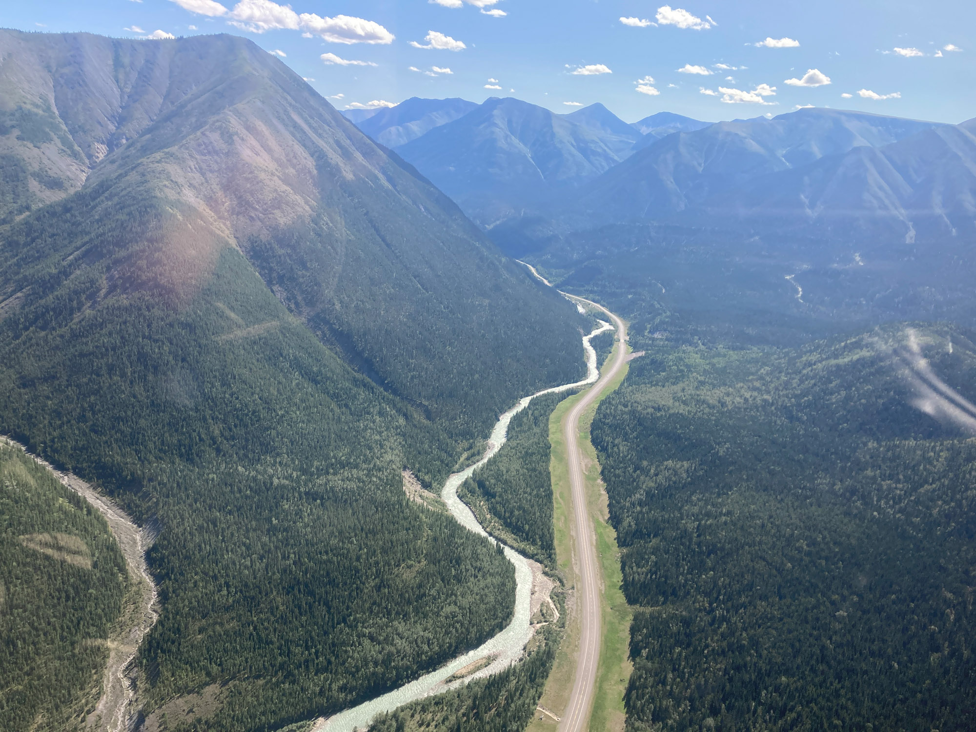
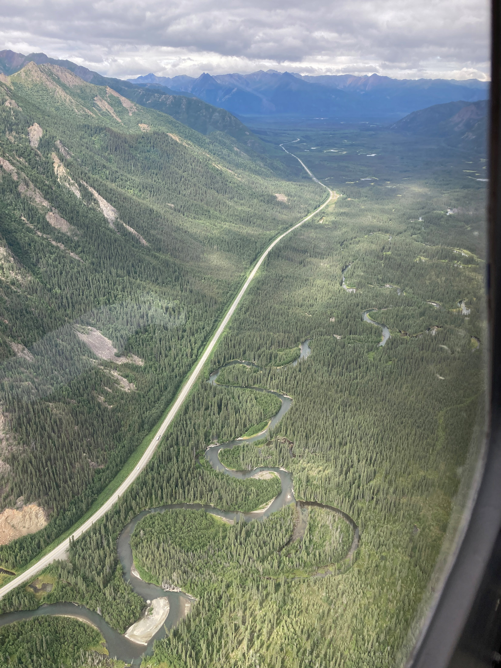
Whitehorse to Watson Lake via the Alaska Highway
I recommend this route only in excellent weather. The mountains are close on both sides of the valley. It is tight with lots of turns as the chart shows.
Notice how the Canadian chart shows the recommended route with diamonds. The recommendations are generally quite good. You can see where they are keeping you away from high ground. It is not perfect, so apply judgment. I followed the diamonds. The waypoints are to mark turns and for situational awareness if I have to turn back.
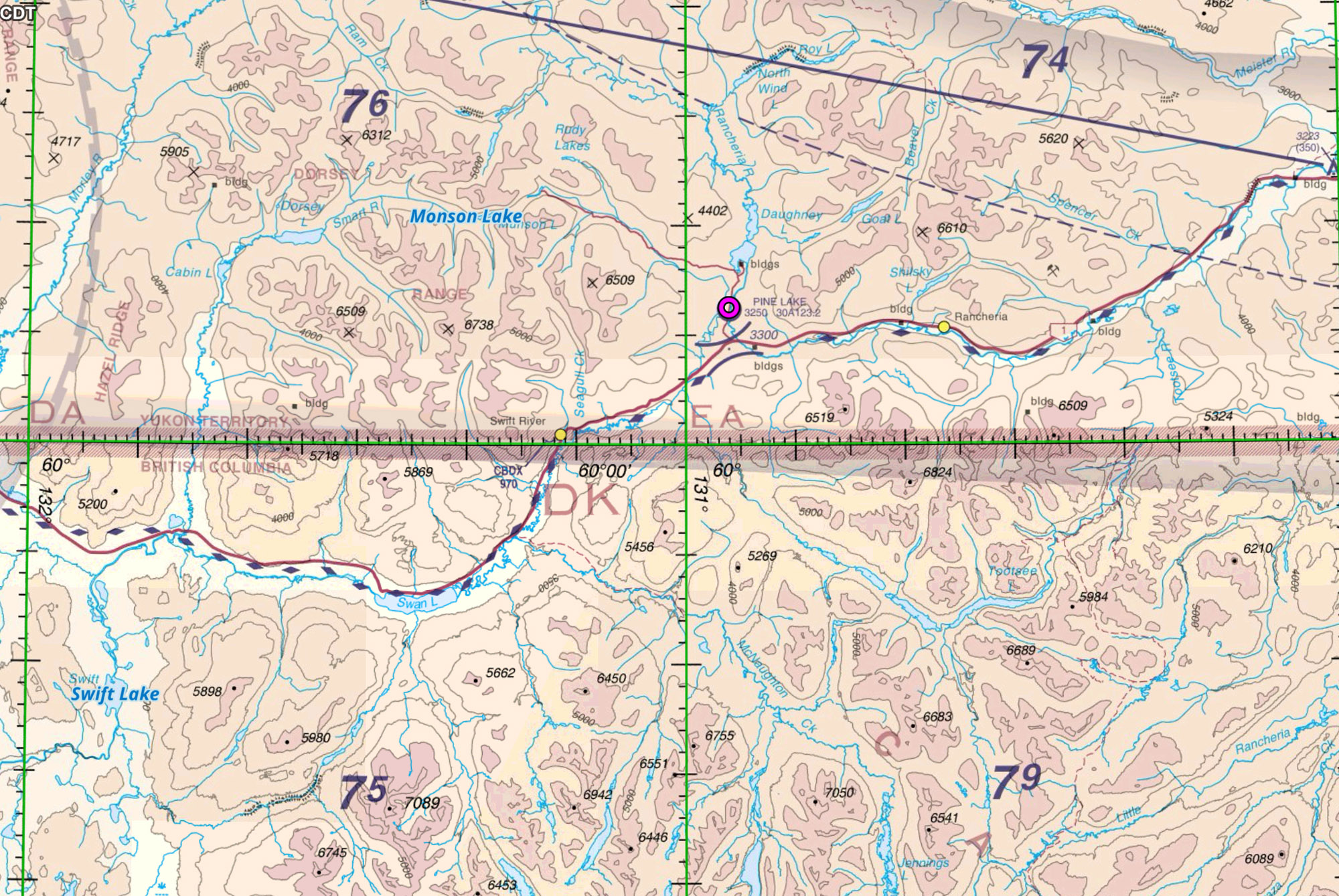
An alternate route is the Liard River marked in red. This follows a broad valley at lower elevations. Consider this route if weather is less than ideal.
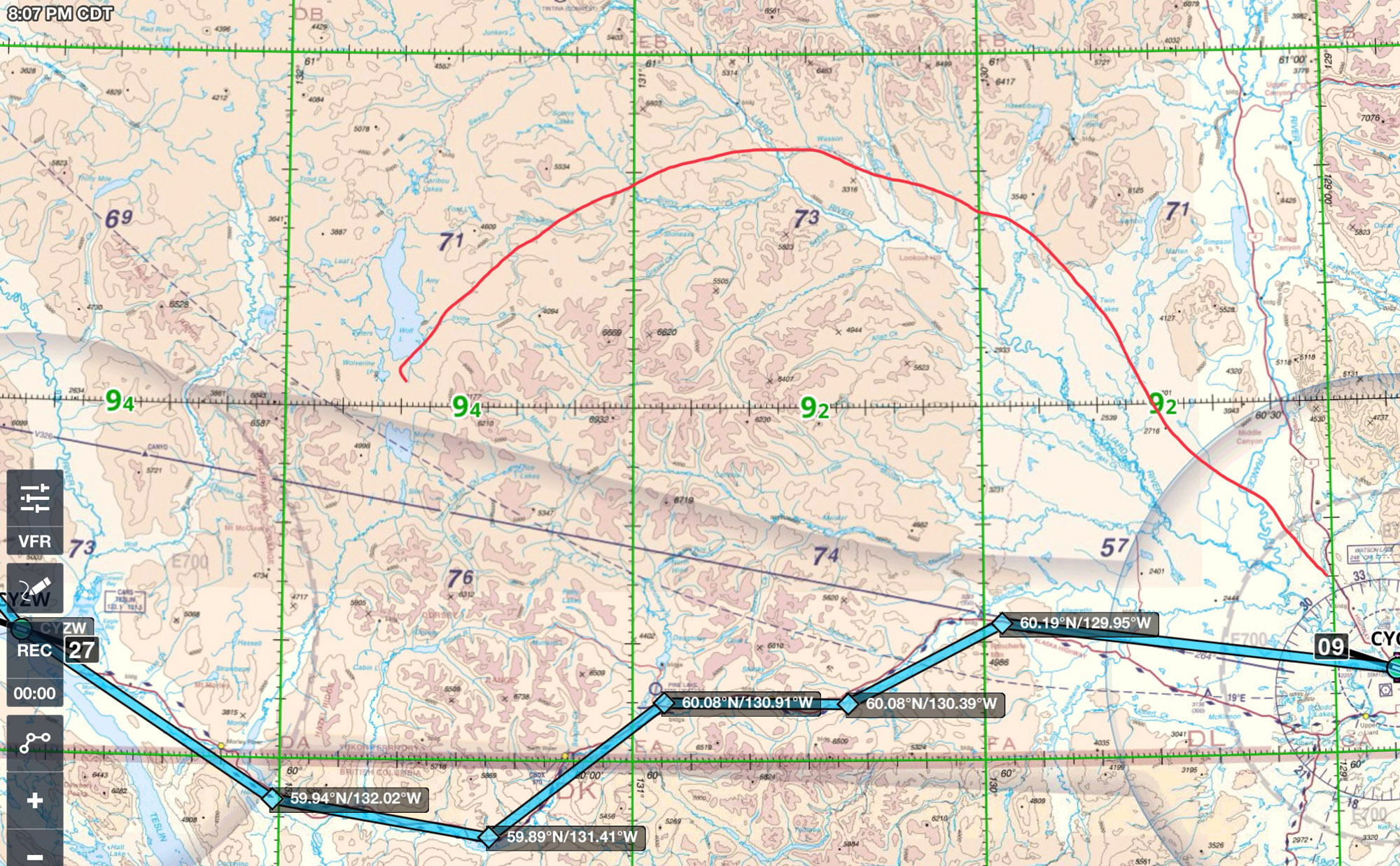
Another option is to fly above the mountains. You would have to fly at 10,000’ as mountains are close to 8000’. Ceilings may not allow this option.
Other Places
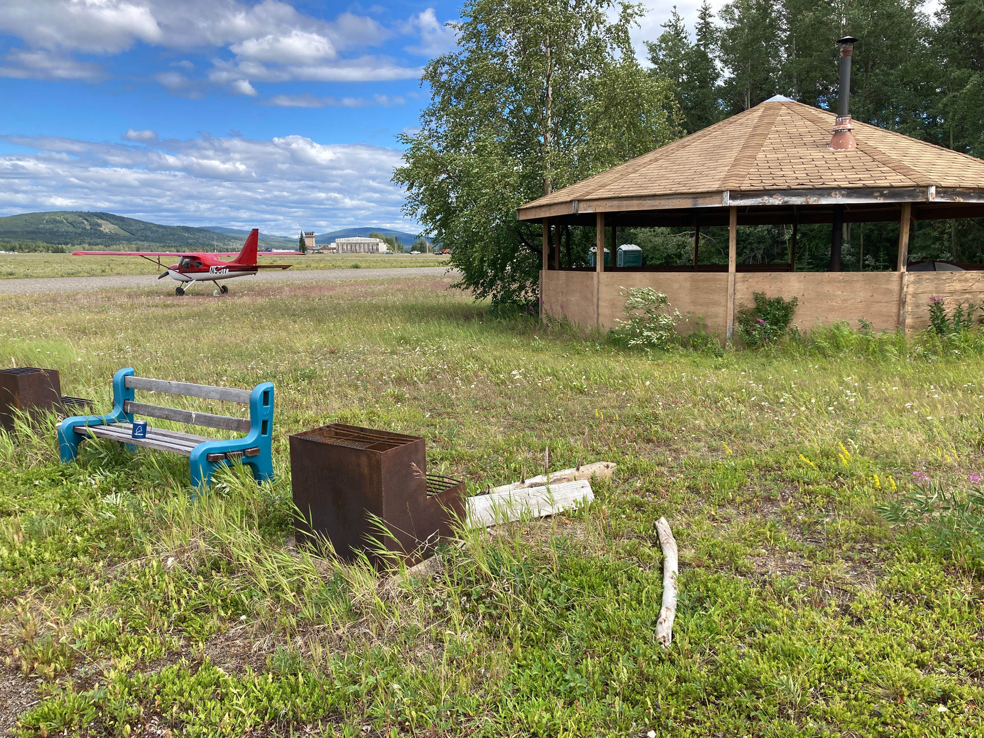
Whitehorse Park by the tower and walk to the Transportation Museum marked by a DC3 on a pylon. I stayed in town. Restaurants and clubs were within walking distance of the hotel.
Palmer Look for two Flying Boxcars. I met the owner, John, an Alaskan character. He gave me the full tour and told great stories about these planes. I used Palmer as a layover when the passes to Gulkana were marginal. Palmer has FBO’s and services. Motels and restaurants are not in walking distance.
Brandon, Manitoba This was among the largest pilot training fields in WW2. Some original buildings still stand. There is a museum with aircraft I regret not having time to visit. Wind and thunderstorms are ferocious. Put your plane in a hanger if possible. If outside, don’t use a cover. The wind will tear it apart.
The Return Flight
Prairie Flying
It is tempting to relax when out of the mountains and over flat land. Don’t. This is remote wooded land with few places to put down. There are long stretches with no roads or settlements. The patchwork of abandoned roads from oil exploration lead nowhere. It may be 100 miles or more between airports. Airports with fuel are far between. There are long stretches without ATC radar coverage.
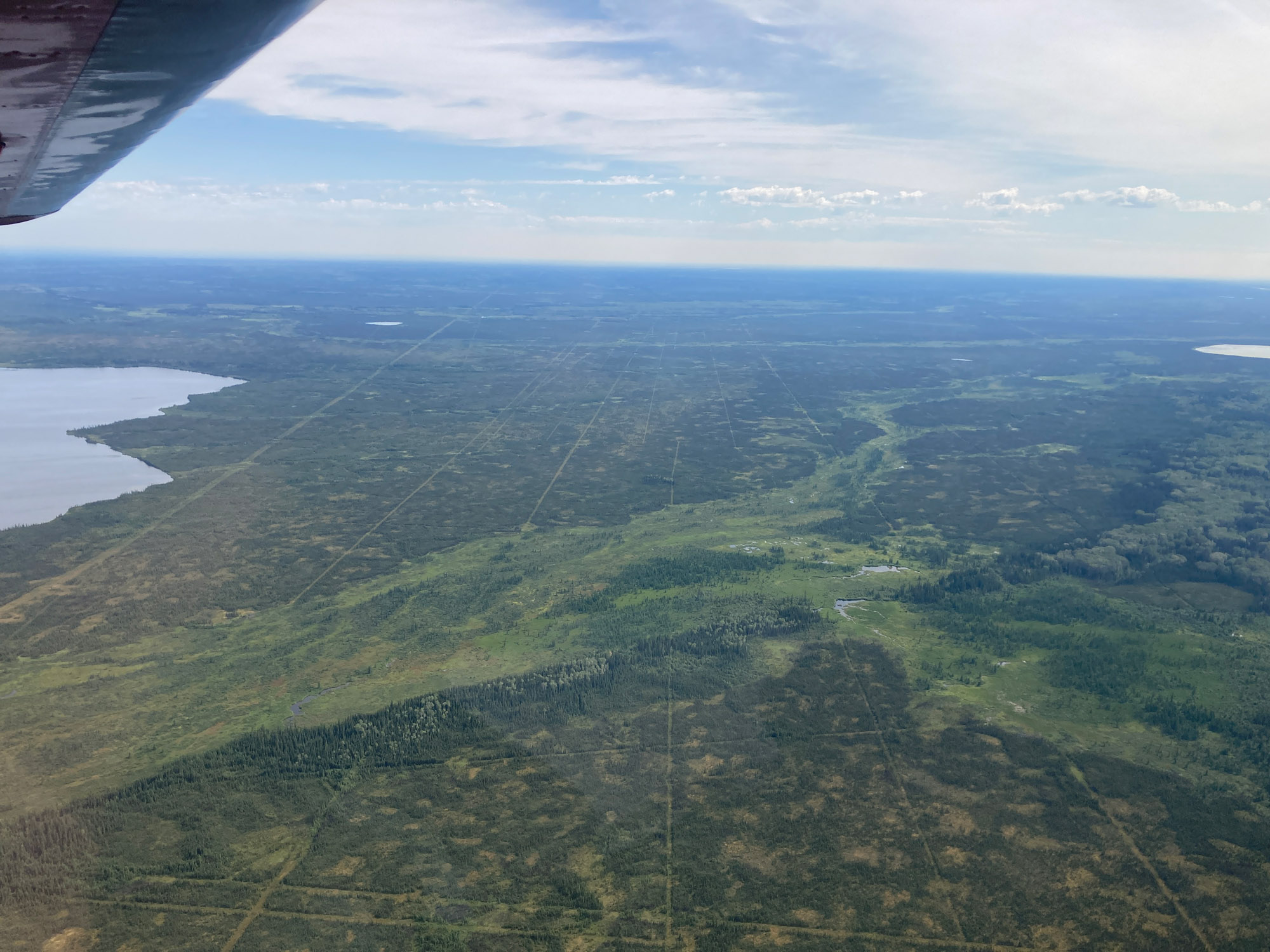
Have lots of fuel. Again, I landed at an airport unable to refuel. Arnprior CNP3 is self serve but the card reader only accepted member cards, not credit cards. Being a holiday, there was no one there to process a credit card in the office. The holiday was First Monday in August. Be forewarned for unfamiliar holidays. A local pilot offered to let me use his card and pay him later but I had enough fuel to continue.
I crossed the border at Piney Pinecreek 48Y. Use K48Y for EAPIS. There is no wait for customs to process an airliner here. Airliners don’t land on the 3300′ runway.
Back to Canada
After crossing at Piney Pinecreek, MN 48Y, the plan was to fly south through Wisconsin past Chicago then east—the Oshkosh route. There were storms in Wisconsin and Minnesota so I went east to Sault Ste. Marie, MI intending to fly down Michigan’s Upper Peninsula the next day.
South was not an option. The weather throughout the central US was terrible. So, I went back to Canada! I flew a “great circle” route from Sault Ste. Marie to Wiscasset, Maine in one day. This required going through customs twice; Sudbury, ON and Ogdensburg, NY. Beware of outrageous ramp and facility fees at Ogdensburg (KOGS) for a small airport. Customs has to drive to the airport so be accurate on your arrival time.
I landed at Wiscasset, ME at 7:55 pm 8/6/24.
Stats
- Miles flown: 7483 nm 8600 sm
- Hours Logged: 98 hrs
- Tach time 85 hrs
- Duration: 1 month
- Fuel consumed 700 gal estimated
Expenses
Expenses totaled about $9500 including fuel, lodging, restaurants and entertainment including a fishing charter. $5500 was on fuel. Fuel cost in Canada after applying the exchange rate was typically US$7-8 (CAN$2.50/liter). US$12/gal was the highest paid anywhere. There were a few $10/gal stops. Maine is far from Alaska and I was gone a month. Your expenses may differ.
I brought three credit cards from two banks in case a card was blocked or was a brand not accepted. No credit card problems were experienced. I brought $1500 cash primarily for fuel if needed. I spent little cash. Canadian dollars were used for cabs (no Uber even in cities like Whitehorse) and convenience. NAV Canada and landing fees (not included) totaled less than $100.
- Fuel $5527
- Lodging (13 nights) $1854
- Restaurants $735
- Entertainment, fishing $1117
- Misc, groceries, taxis $270
- Total $9503
Tips and Lessons Learned
Mountain Flying
My experience is that the calmest air is in the valley about 1/3 the distance below the height of the mountain tops. I found the air remarkably smooth following this practice. I experimented with different altitudes. Flying level with the mountain tops or above was usually turbulent. Get used to seeing land close off your wingtips.
Traffic Avoidance
Flight following is seldom available in northern Canada. Monitor 126.7 and report your position periodically. This is the traffic frequency. They use it throughout the province like we use Unicom at an airport. A typical announcement leads with “Position report or traffic report or 1267” so flight service knows someone is not calling them and to get pilots attention. “Position report: N5617 is 50 miles southwest of Saskatoon east bound at 4500 ft.” Make the same report on the mandatory frequency when within 20 miles of one. The mandatory frequency if manned, will likely ask your departure point, destination and aircraft type for their log, When approaching an airport with a manned mandatory frequency, say “North Bay Radio, N5617”
Procedures are different in Canada and Alaska
In Canada they have Mandatory Frequency. You must announce your position at a certain distance from the airport even if not landing. The MF distance and altitude are in the Canadian Flight Supplement. The distance is typically 5 miles for small airstrips.
At some Canadian airstrips there will be a radio operator on the Mandatory Frequency during certain hours listed the Canadian Flight Supplement. Think of them as a controller without full privileges. The operator will give favored runway, traffic and weather. They can close your flight plan. When departing, contact the operator when ready to taxi. Sometimes they assign a squawk code for the flight. You keep the code even though you are not in communication with ATC. Fairbanks did this too.
Alaska has developed a similar radio operator system. At airports like Homer and Talkeetna, there is no control tower. There is a radio operator often as busy as a controller talking like a controller. They can’t order you to do something like a controller but you best inform them of your intentions and heed their advice. The presence of a radio operator is not indicated on the chart or supplement. They reply to your incoming announcement. Monitor the CTAF frequency.
In Canada your flight plan is automatically activated at the time stated on the plan. It is not file and then activate like the USA. This makes sense because you may not be in a place with cell, landline or radio coverage. Don’t forget to cancel your flight plan if you don’t go.
In Canada, a flight plan is mandatory for flights over 25 nm. Simply telling someone your destination and expected time of arrival so they can report you overdue meets the flight plan requirement. I filed a flight plan for nearly all flights in the north. I also had a friend following my progress.
In the USA, pilots are encouraged to file a separate flight plan for each leg of a VFR flight. In Canada, filing a single VFR flight plan with intermediate stops was encouraged by a Flight Service specialist.
In Canada, pilots often fly over midfield at pattern altitude and then turn downwind. The midfield approach often makes sense as there may be hills and mountains to one side. This approach also keeps the runway in sight when it is hidden in the trees. There is little traffic.
In the US, the midfield approach is discouraged. There is more traffic. A midfield approach can cause a midair as the banked plane can’t see traffic on normal downwind. I experienced a near midair from a pilot doing this in the US.
In Canada and Alaska, many planes fly without radios.
ADS-B has no service in most of Alaska. Canada got it right with satellite ADS-B service.
Tip: Navigation Software Anomaly
Always check to see if where the navigation software is telling you to go makes sense. In the middle of nowhere, ForeFlight’s Bearing to Next Waypoint instrument was sending me in a direction that definitely wasn’t to Fairbanks! What a time for a software glitch, I thought. What happened is that Bearing to Next had switched from magnetic north to true north without any action on my part. It was giving bearings in True while I steered Magnetic.
ForeFlight doesn’t make magnetic measurements. It just applies a correction. I suspect when this far north where lines of longitude converge and sensing magnetic north is unreliable, pilots fly true headings and ForeFlight has some algorithm that switches over. It switched back to magnetic when I got further south.
Alaskan and Canadian pilots are great people and helpful.
Talk to the local pilots. Most are eager to help. There is a lot of info that is not on ForeFlight when flying in Alaska and the Yukon.
For example: When I wanted to fly a glacier at Denali, a tour pilot downloaded all the reporting points as an overlay onto ForeFlight which is not available from ForeFlight. Since there is no ADS-B, reporting points are vital for traffic separation. There have been several midair collisions over the years.
A pilot walked me through his preferred approach to Merrill Field through complicated Anchorage airspace. It was a way I never would have thought of. He also provided a sector frequency overlay onto ForeFlight which is not available from ForeFlight. The frequencies are available in the Alaska Flight Supplement but are next to useless since they are not on the chart. Sector frequencies are for traffic advisories when flying through a region, not just near airports like Unicom. Know which frequencies to monitor.
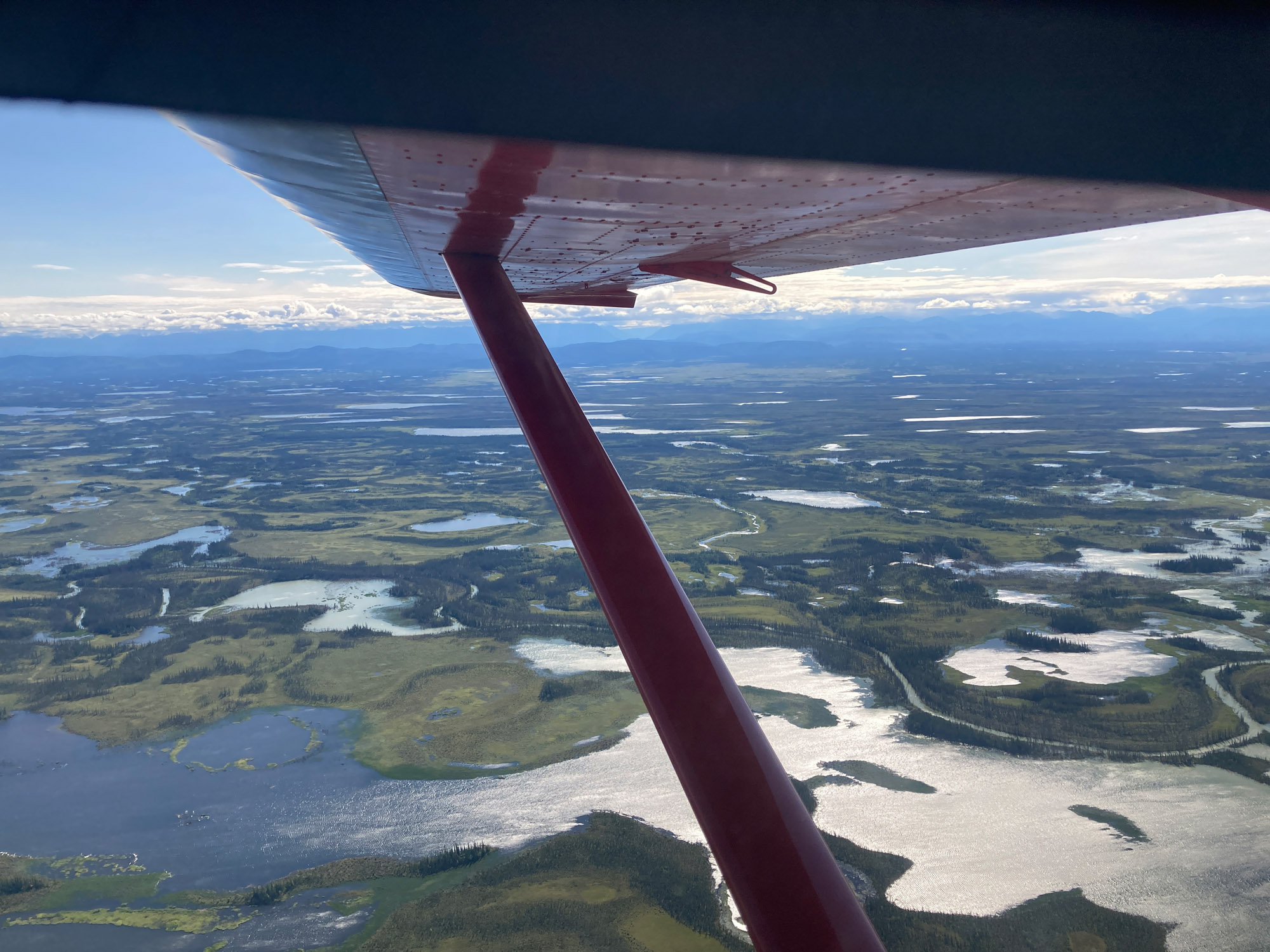
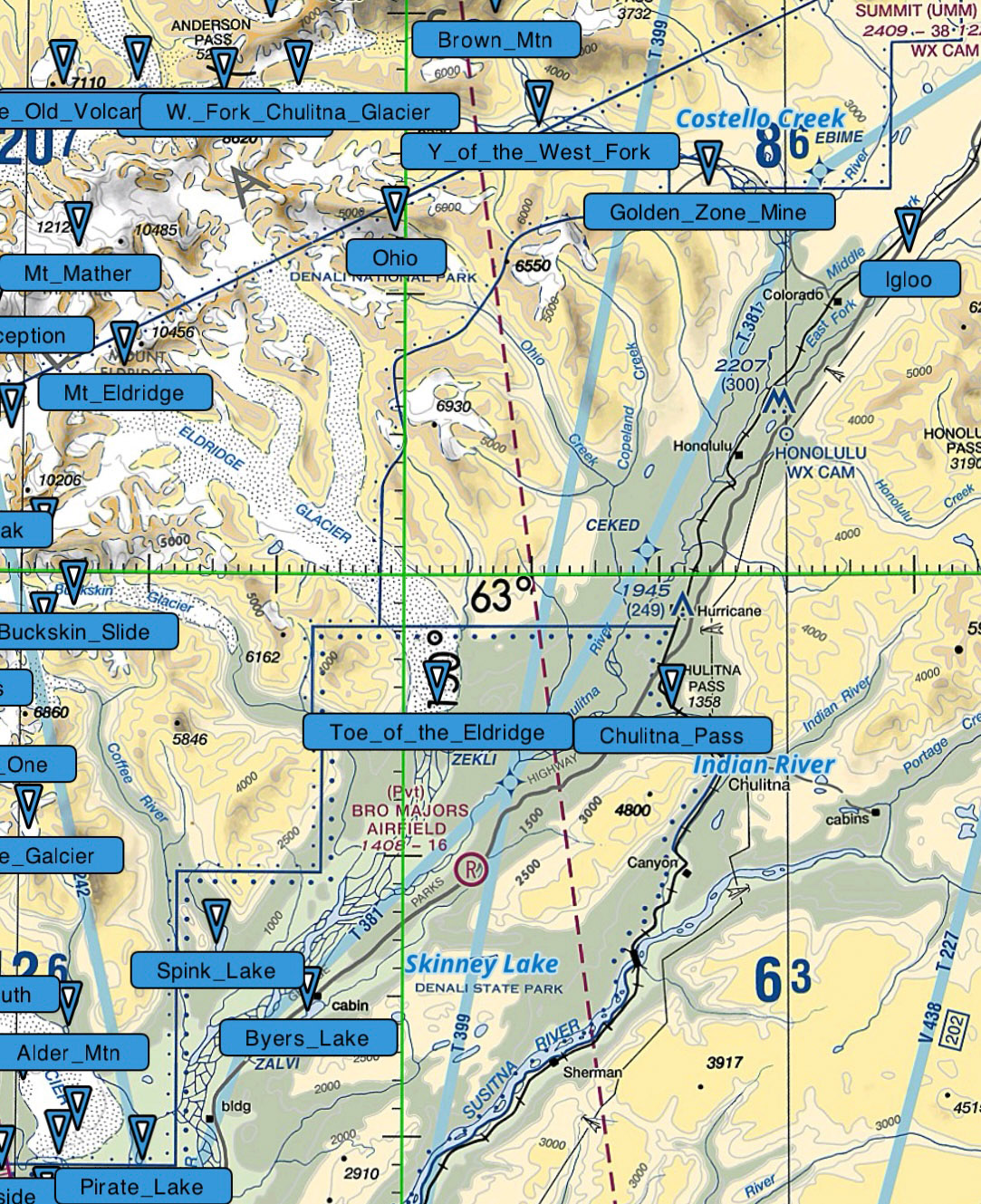
A pilot who I truly would like to thank is an unnamed voice on the radio. The forecast south from Denali to Talkeetna was MVFR overcast 1400’. A third of the way, it looked like 500’ ceilings ahead. On the correct frequency, I radioed “Any aircraft south of The toe of Eldridge (reporting point) for weather.” An Alaskan pilot came back and said “There is a big hole at Byers Lake (reporting point). You can fly over the top, drop through and fly under to Talkeetna.”
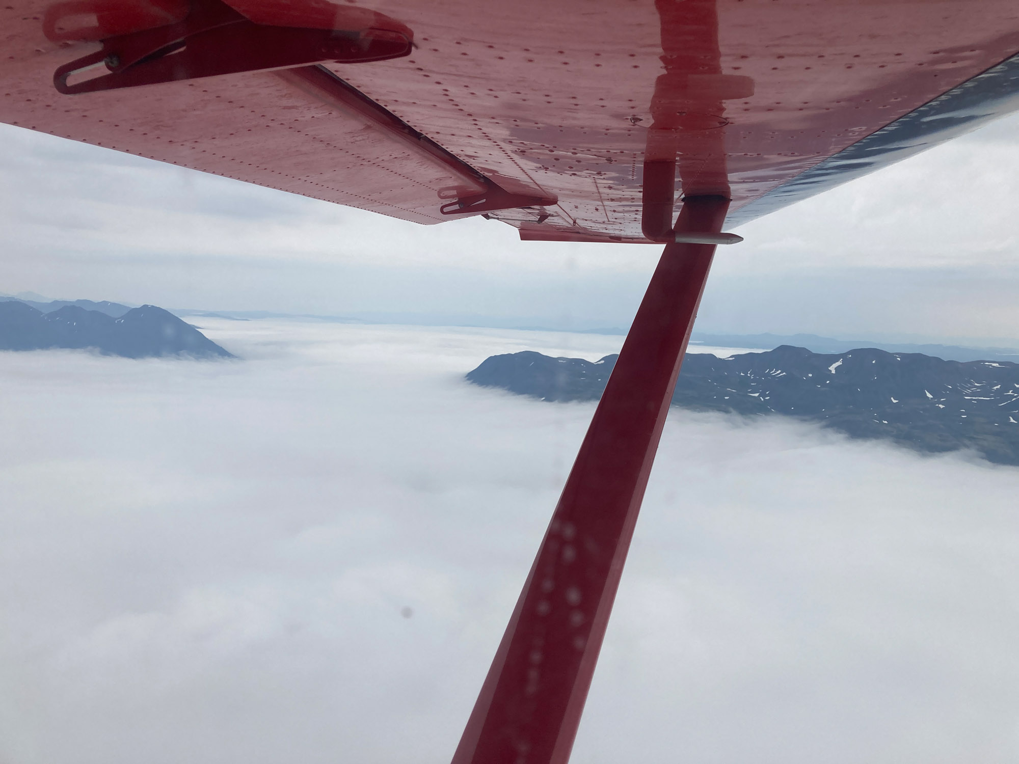
This was an intense flight I will never forget; Flying over the top with mountains sticking up through the clouds. Was the hole still there and could I find it? If not, I would have to turn back.
I had departed without full tanks as there is no fuel service at McKinley. There were few airstrips and none with fuel before Healy if backtracking.
Flying at the maximum range power setting, noting times, and calculating the point of no return, I found the hole and made it to Talkeetna with fuel to spare. Thank you unknown Alaskan pilot.
Tell people where to call if your aircraft is overdue
When flying in Alaska and Canada, people back home won’t know who to call if your flight is overdue. Be sure a key person knows what number to call to report an overdue aircraft and has pertinent aircraft info: N number, color and type code.
In Canada, an overdue aircraft is reported to The JRCC (Joint Rescue and Coordination Center) Victoria 250 413-8933 servicing British Columbia and the Yukon or JRCC Trenton 613-965-3870 servicing Alberta, Saskatchewan, Manitoba, Ontario. A person can also call Canada Flight Service 866 541-4101 when calling from the US. The WxBRIEF toll free number does not accept calls from US cell phones.
In the lower 48 USA, an overdue aircraft is reported to Flight Service. However Alaska Flight Service is a separate organization. An overdue flight in Alaska should be reported to an Alaskan Flight Service facility like Fairbanks 866 248-6516 for better communication.
Where’s Andy? Lesson Learned
It is important to explain PLB tracking limitations to followers. It is not real time like they see in FlightAware. It sends a position report at programmed time intervals. It doesn’t transmit if the unit has stopped moving. The last position displayed online may be miles from the airport if the plane lands and stops moving before the next report is transmitted.
Bill, a friend and my overwatch, saw the plane’s last location was over a wooded area 20 miles from the airport and hadn’t moved for hours. There was no reply to his text. So he did as he should and reported his concern. Search and Rescue located my plane at the airport, contacted Bill, and left a friendly note on the plane. For future flights, I increased the reporting interval; reminded myself to call Bill upon landing and agreed Bill would call and text me before calling Flight Service.
How was the smoke through Canada?
I did not encounter any smoke on the Cassiar Highway route. However, a pilot I met in Minnesota taking the Alaska Highway route was stuck in Fort Nelson for a week due to smoke. On the return trip I did see smoke. It wasn’t hazy and black. It looked like an atomic bomb cloud; white and rising thousands of feet. There was no way I could have flown through or over it. I easily went around it. There was no TFR.
Tip: Wildfire TFRs do not show on Canadian charts in ForeFlight when “Show TFRs” is toggled on. You have to turn on Show NOTAMS to see wildfire TFRs in Canada.
Flying above the TFR ceiling may not be possible due to turbulence and low visibility. It may be flyable on the upwind side of the TFR. Flight Service Canada may be helpful on suggesting a way around. I called when considering Fort Nelson.
I did encounter a TFR at Denali right off the end of McKinley airport. Although there was no smoke, a fire can continue to burn underground in the tundra. Firefighters fly drones and send people in to inspect. A survey pilot said he calls the number posted with the TFR if he wants to take off north and they tell whether drones are in the air and if it is okay to take off.
Registration Number Size
12″ numbers are not needed to fly in Alaska unless flying over the ADIZ zone. The ADIZ is only five miles offshore along the coastal route of Alaska. Canada allows US amateur built aircraft to fly in Canada with 2-3 inch numbers. A Canadian EAB document allows US amateur built aircraft to operate in Canada and should be carried onboard.
What do you mean my phone won’t work in Canada?
My provider assured me it would. There is a problem with NAV Canada’s Flight Service phones and US based cell phones. NAV Canada explains this on their website. They tell you to go to the Canadian Flight Supplement where there is a special number for US based phones. However you may be routed to Kamloops or somewhere 800 miles away. That center will wonder why you are calling them and have to look up your plan because it is not in their sector.
Alaska weather—You can’t beat the house.
I had exceptionally good weather on this trip until flying from Seldovia to Palmer PAAQ, an airport just northeast of Anchorage. Everywhere was VFR except Anchorage which turned IFR. I tried going east of Anchorage only 20 minutes from good VFR but could not get through.
Flight Service said it was clear all over to the west of Anchorage so I turned west. Low ceilings. I’m flying at 500’ and not comfortable. Then I see the local pilots 300’ below me at 200’ AGL as if they were commuting! It was flat land with no towers. The nearest airport with MVFR was Talkeetna 75 nm away. So again at Talkeetna. Overnight. Yes, Mountain High Pizza is good!
Alaska weather – You landed where? What flight plan?
Flying from Tok, Alaska to Whitehorse, Canada to clear customs. Sunny skies after leaving Tok and en route. Whitehorse is VFR. About a third of the way, I run into a wall of weather. And I’m in a valley between mountains. No ADS-B weather radar.
Sometimes the bad weather is only for a short distance in a pass then good. I radioed Canadian Flight Service (These people are good and care.) It wasn’t temporary. I had to turn back and land at the nearest airstrip.
I landed at Beaver Creek which is NOT where customs was waiting for me. Although it is an AOE15 airport, I’ve landed there without permission; a fineable offense. I’m thinking I better call someone to send money and lawyers. I called customs. Canada has one number for all aviation customs calls. They were nice. After being put on hold and conferring, they said everything is okay because I had obtained a customs report number before entering and had the permit number for the firearm. They cleared me into Canada. They said there was no need to report to customs in Whitehorse. I could go anywhere I pleased. Wow!
I called Canada Flight Service right away after landing. They had the flight plan but did not show it as active. They would not have started a search. Fairbanks had no record of this flight plan. They would not have started a search! They expressed concern. The manager called me as did the pilot liaison. They are starting an investigation. This is not supposed to happen. Later I get a text from ForeFlight that my flight plan hasn’t been closed.
Lessons learned: Carry extra fuel. Beaver Creek does not have fuel. Turning back north and then flying south the next day over the same ground used more fuel than planned. I flight plan a two-hour reserve minimum on a flight like this. That paid off.
When doing international flight plans, verify they are active with both countries. Filing ForeFlight has been fine for flights in Canada and across borders with the above exception which likely had nothing to do with ForeFlight.
Alaska weather can change like the roll of the dice.
Fuel Pump Fandango
Some card readers in Canada will ask “Do you have a fuel access code?” on the first screen. Of course you don’t. You have never been here before. Is it an access code for a company account? Good guess, but no. It’s a code to prove you have training on how to refuel an aircraft at this location. Respond “No Code” and the card reader display gives you training, several screens worth of safe practices and emergency procedures. Then it prints out a code. Reinsert your credit card and enter the code. The code is good for subsequent use of this pump.
Securing Baggage
It is good practice to secure baggage from coming forward in event of a crash. One inch nylon webbing was attached from the top of the cage to eyebolts on the baggage floor. The webbing has a tensile strength of 600 lbs; considerably more than a typical pickup truck cargo net. Quick links were used because they screw closed. Spring link carabiners were found to open inadvertently. Ladder lock buckles and tri-glides allowed straps to be quickly adjusted and connected. Buckles have a lower breaking strength than the webbing, 150 lbs, but the load was spread over four buckles.
Customs Experiences
Without exception, every American customs officer was pleasant and easy to work with. Canadian customs officers were nice, but we expected that.
A Canadian customs officer questioned why I wanted to go back to Canada after leaving Canada the day before. I understood the suspicion. I explained the weather south and had no problem.
The CANPASS customs officer on the phone assured me I would be met by customs officers at the AOE/15 airport because of the firearm even though I offered the permit number. I was sternly told not to leave the airport and not to get out of the plane until they arrived. I was not met by officers. I called customs and told them and where I was on the field in case the officers were waiting elsewhere. They said I was cleared to proceed.
US Customs at Ogdensburg, New York asked to see my pilot’s license. That was the first time anyone in customs or otherwise asked to see it. They looked at my passport and that was it. Then we chatted about a place in Maine he had been to.
Canadian customs at Piney Pinecreek unloaded everything in the airplane except the bicycle while I stood away. They had to bring an additional table onto tarmac. They were very polite and offered to carry items back to the plane.
Crossing the border at Piney Pinecreek
Technically we do not fly across the border at Piney Pinecreek. We taxi. The runway straddles the border. Nevertheless, a flight plan is required despite misinformation contrary on the web. EAPIS is required. EAPIS wants K48Y, not 48Y as shown on the chart. An advance call to Canadian customs is required. If you need fuel when crossing to Canada, clear Canadian customs first then taxi to the fuel pump on the US side. You won’t have to get permission taxi to the runway on the Canadian side per the US customs officer. The fuel pump dispenses a maximum something like 10 gal or so per credit card transaction then you have to start over. It is also advisable to confirm fuel is available. I recommend fueling a Roseau (KROX) 14 nm southeast. (*The Piney Pinecreek airport permanently closed on December 27, 2024)
When to fly to Alaska
I recommend between July 1 and August 15 because:
- Temperatures are favorable. I encountered 33°F on a couple of mornings. I wouldn’t want colder for camping. There is lots of snow in the mountains and glaciers in July.
- The days are long. That is helpful when you can’t get an early start due do morning weather or are late arriving at a destination.
- They say mosquitoes are worse but I had no problems. Mosquitoes are more active at dusk which isn’t until 11 pm.
- The air is generally smooth probably due to the long days.
- Wildfires are a special consideration. Generally, avoiding wildfires favors heading to Alaska earlier in the summer. So perhaps arriving mid-June is a consideration.
An excellent site on flying to Alaska is fly2ak.com. His comments are:
June & July are typically drier than August; June and July are peak mosquito season (though I’ve never had issues in any month per se). Late August into early September offers generally dry weather with gorgeous fall colors–yet the morning temps are trending downward to there even being snow (at least at higher elevations).
Apps
Windy – Used for aviation weather and winds aloft. This app is used by many Canadian pilots. I found the NAV Canada weather map graphics antiquated and the site not user-friendly. Windy has more current winds aloft than the US and Canadian aviation weather sites. The satellite cloud views are a go-to for local pilots.
TLAR – This is a takeoff and landing distance calculator based on sophisticated aircraft modeling. The Sportsman is the database. Input aircraft particulars like engine and weight. Given load, temperature, elevation, and flap settings; it calculates takeoff landing and distances, Vx, Vy climb speeds, plus other speeds and parameters. The calculated best angle of climb speed provided significantly better performance than the generic Vx speed in the manual. I found this to be a useful app.
AircraftPower – This is a power calculator given manifold pressure, RPM, altitude and temperature. It is more accurate and quicker than interpolating from a table. Power settings can be previewed in the air or on the ground. I used it often in the air with steam gauges.
ForeFlight – ForeFlight with Canadian charts worked well. However, information on airstrips is lacking. It is essential to have the Canadian Flight Supplement. CFS airport info is available with a tap on the airport page after downloading the CFS into ForeFlight. Also have the Alaska Flight Supplement on Foreflight. The quick access is helpful. Area frequencies and reporting points can be overlaid onto ForeFlight charts. The overlays enhance flight safety especially in remote areas, high traffic over glaciers, and in airspace around Anchorage.


Thanks for this write-up Andy! It will very helpful for my journey north this summer!
Good job great adventure
Thanks Chris and Kyle. I hope you go there.